
Displaying items by tag: mapping
ArchAtlas
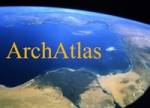
ArchAtlas is a web-orientated archaeological mapping and research project. It is developed at the Department of Archaeology, University of Sheffield, UK.
The ArchAtlas project aims to provide a visual summary of spatial processes in prehistoric and early historic times, such as the spread of farming, the formation of trade contacts, and the growth of urban systems, and to illustrate the locations of key archaeological sites. It uses GIS techniques to integrate georeferenced information on archaeological sites, cultural entities and contact routes with environmental data and satellite imagery.
DeLorme

DeLorme is a vendor of mapping and GPS products and technologies. It is based in Yarmouth, Maine, United States.
DeLorme's products include Street Atlas USA, XMap, Topo USA and Earthmate GPS receivers (PN-20 and PN-40, BT-20, and LT-20).
The company is also a data solutions provider to several major businesses and industries.
Its headquarters features Eartha, the world's largest rotating globe. (in 2012)