Displaying items by tag: GeoEye
IKONOS
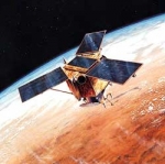
IKONOS is a commercial earth observation satellite, and was the first to collect publicly available high-resolution imagery at 1-meter and 4-meter resolution. It offers multispectral (MS) and panchromatic (PAN) imagery.
IKONOS imagery began being sold on January 1, 2000.
It derived its name from the Greek term eikōn for image.
It is operated by GeoEye.
GeoEye Inc.
GeoEye Inc. (formerly Orbital Imaging Corporation or ORBIMAGE) is a commercial satellite imagery company based in Herndon, Virginia, USA.
GeoEye operates its own fleet of Earth observation satellites, which provide visible and near-infrared images of land and sea at resolutions below 1 m.
GeoEye provides 253,000,000 square kilometres of satellite map images to Microsoft and Yahoo! search engines. Google has exclusive online mapping use of the new GeoEye-1 satellite. It is a major supplier to the USA National Geospatial-Intelligence Agency.
GeoEye's headquarters are in Herndon, Virginia. Satellite Operations are conducted in Herndon, Virginia and in Thornton, Colorado. The location in Saint Louis, Missouri provides additional image processing. There are multiple ground stations located worldwide.
GeoEye's primary competitors are DigitalGlobe and Spot Image.
The company was founded in 1992 as a division of Orbital Sciences Corporation in the wake of the 1992 Land Remote Sensing Policy Act which permitted private companies to enter the satellite imaging business. The division was spun off in 1997. It changed its name to GeoEye in 2006 after acquiring Denver, Colorado-based Space Imaging. Space Imaging was founded and controlled by Raytheon and Lockheed Martin. Its principal asset was the IKONOS satellite.


