
Copernical Team
Image: Tethered satellites for propulsion without fuel
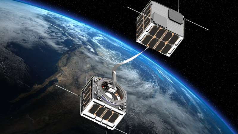
How to propel a spacecraft without propellant? Use electrodynamic tethers. These are long, strong conductors connecting two spacecraft. When direct current is applied to the tether, the tether exerts a force on the spacecraft, causing it to either accelerate or brake.
Such tethers might be used to perform fuel-free orbital maneuvers, or deorbit satellites at the end of their working lifetime to prevent buildup of orbital debris.
Universidad Carlos III de Madrid in Spain has proposed an improved tether design incorporating thin film solar cells to harvest added power for the tether plasma circuit, intended for end-of-life deorbiting.
The idea was proposed through ESA's Open Space Innovation Platform (OSIP) Open Discovery ideas Channel, seeking novel ideas for new space research activities. This innovative concept has been accepted by ESA for implementation, along with numerous others.
Explore further
Video: Impression of Webb's journey to space

The James Webb Space Telescope will be the largest, most powerful telescope ever launched into space.
Webb's flight into orbit will take place on an Ariane 5 rocket from Europe's Spaceport in French Guiana.
Webb is the next great space science observatory, designed to answer outstanding questions about the Universe and to make breakthrough discoveries in all fields of astronomy. Webb will see farther into our origins—from the formation of stars and planets, to the birth of the first galaxies in the early Universe.
During the first month in space, on its way to the second Langrange point (L2), Webb will undergo a complex unfolding sequence. Key steps in this sequence are unfolding Webb's sunshield—a five-layer, diamond-shaped structure the size of a tennis court—and the iconic 6.5-meter wide mirror, consisting of a honeycomb-like pattern of 18 hexagonal, gold-coated mirror segments.
Working with partners, ESA was responsible for the development and qualification of Ariane 5 adaptations for the Webb mission and for the procurement of the launch service. As well as launch services, ESA contributes to two of the four science instruments (NIRSpec and MIRI), and provides personnel to support mission operations.
Australia plans lunar rover to help NASA find oxygen on moon

Australia has agreed to build a 20-kilogram (44-pound) semi-autonomous lunar rover for NASA to take to the moon as early as 2026 in search of oxygen.
What a blast: The rush of amateur astronauts

As veteran actor William Shatner—Captain Kirk of "Star Trek" fame—becomes the latest celebrity to go into space on Wednesday, we look at the recent rush of amateur astronauts.
Beam me up, Bezos
Shatner went where no 90-year-old has gone before aboard Amazon founder Jeff Bezos' Blue Origin rocket.
The Canadian became the oldest person to go into space on the flight, beating pioneering female pilot Wally Funk, 82, who also flew with Bezos in July.
Shatner experienced a few minutes of weightlessness 60 miles (100 kilometres) from Earth, before returning in the reuseable rocket.
Bezos and his brother Mark were also on Blue Origin's maiden mission in July.
Russian first
Last week, Russian actress Yulia Peresild blasted off to the International Space Station with a film director to try to pip the United States in making the first feature film in orbit.
They want to best "Mission Impossible" star Tom Cruise who announced his own movie project with NASA and Elon Musk's SpaceX last year.
They hope to wrap their story about a female surgeon who is dispatched to save a cosmonaut by the time they touch down on Sunday.
William Shatner to be oldest astronaut at 90: How space tourism could affect older people
Is space really the final frontier? William Shatner is set to find out as he boldly goes where no 90-year-old has gone before. Some 55 years after Captain James T Kirk hit our screens in the original Star Trek, Shatner will launch to the edge of space aboard Blue Origin's New Shepard for a ten-minute sub-orbital flight.
Shatner will become the oldest person to go to space, breaking the record set only recently by 82-year-old Wally Funk, who traveled on the New Shepard's first crewed spaceflight in July. Funk was one of the Mercury 13 women who qualified for spaceflight in the 1960s but never flew.
With commercial spaceflight companies now taking older people to space, it's timely to consider the potential physical impact space flight might have on them.
In just a few days in space, the human body starts to adapt. Astronauts' bones start to lose density and their muscles become smaller and weaker because they're not being used to stand up against gravity or to move around.
William Shatner, TV's Capt. Kirk, blasts into space
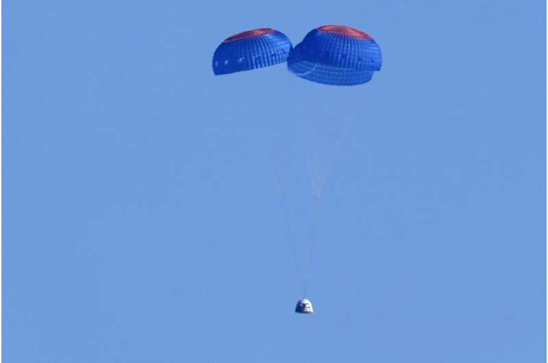
Hollywood's Captain Kirk, 90-year-old William Shatner, blasted into space Wednesday in a convergence of science fiction and science reality, reaching the final frontier aboard a ship built by Jeff Bezos' Blue Origin company.
The "Star Trek" hero and three fellow passengers soared an estimated 66 miles (106 kilometers) over the West Texas desert in the fully automated capsule, then safely parachuted back to Earth in a flight of just over 10 minutes.
Shatner became the oldest person in space, eclipsing the previous record—set by a passenger on a similar jaunt on a Bezos spaceship in July—by eight years.
Euclid Telescope completes space test in Belgium
 Video:
00:00:41
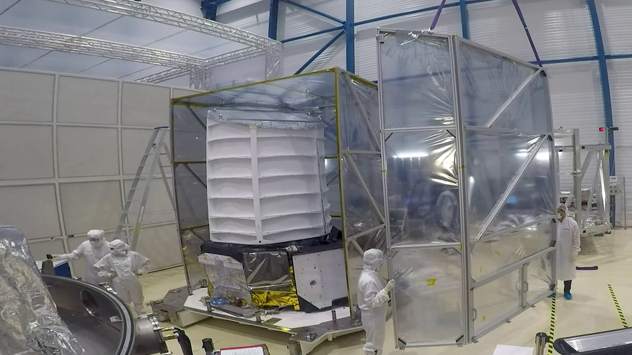
ESA’s Euclid mission aims to investigate dark matter, dark energy and the expanding Universe.
Euclid has reached a new milestone in its development with successful testing of the telescope and instruments showing that it can operate and achieve the required performance in the extreme environment of space.
At Centre Spatial de Liège (CSL) in Belgium, the payload module (containing the telescope and scientific instruments) was packed in a thermal tent, after which it was loaded in a large vacuum tank where it underwent intensive testing.
Euclid experienced simulated space conditions in vacuum with the payload module cooled to -150oC, the
Webb arrives in French Guiana for launch on Ariane 5
 Video:
00:01:54
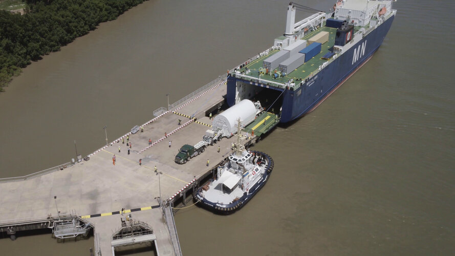
The James Webb Space Telescope arrived in French Guiana on 12 October 2021 ahead its launch on Ariane 5
 Putting Earth observation into ‘the market perspective’

With a boom in the global market for Earth observation information and data products, participants at this year’s Φ-week conference have been digging deep into the ‘market perspective’. This important topic includes how to gain a better understanding of what governments, industry, the public and other users of Earth observation products and services need and expect to create value for society and the economy.
At your Service Module
 Image:
The second European Service Module is prepared for shipment to NASA’s Kennedy Space Center in Florida, USA this week at Airbus facilities in Bremen, Germany. Made up of components from ten European countries, ESM-2 will power the first crewed flight to the Moon on the Artemis II mission.
The European Service Modules are a key element of the Orion spacecraft, the first to return humans to the Moon since the 1970s.
Built by the brightest minds in Europe, the module provides propulsion, power and thermal control and will supply astronauts with water and oxygen. The ESM is installed underneath the

