Displaying items by tag: remote sensing
Magnolia Terra LLC
Magnolia Terra LLC, Moscow, Russia, is a privately-owned company with a mission to provide cost effective quality Remote Sensing Imagery services and to contribute to the development of new technologies. The main goal of development of a wide range of Magnolia-family software products (Magnolia rsLab, Magnolia iMATH, Magnolia psDraw) is to provide solutions for virtually every stage of the satellite data acquisition and satellite data analysis processes.
A resident of the Skolkovo Innovation Centre, the Space Technology and Telecommunications Cluster. Reg. no. 1120388.
Specialties: Earth observation, remote sensing, satellite imagery, software development, geophysics, environmental science.
Magnolia Terra LLC
Magnolia Terra LLC, Moscow, Russia, is a privately-owned company with a mission to provide cost effective quality Remote Sensing Imagery services and to contribute to the development of new technologies. The main goal of development of a wide range of Magnolia-family software products (Magnolia rsLab, Magnolia iMATH, Magnolia psDraw) is to provide solutions for virtually every stage of the satellite data acquisition and satellite data analysis processes.
A resident of the Skolkovo Innovation Centre, the Space Technology Cluster. Reg. no. 1120388.
Specialties: Earth observation, remote sensing, satellite imagery, software development, geophysics, environmental science.
Copernicus Programme
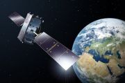
Copernicus is the European Union's Earth observation programme coordinated and managed by the European Union (EU) in partnership with the European Space Agency (ESA), the EU Member States and EU Agencies.
It aims at achieving a global, continuous, autonomous, high quality, wide range Earth observation capacity. Providing accurate, timely and easily accessible information to, among other things, improve the management of the environment, understand and mitigate the effects of climate change, and ensure civil security.
The objective is to use vast amount of global data from satellites and from ground-based, airborne and seaborne measurement systems to produce timely and quality information, services and knowledge, and to provide autonomous and independent access to information in the domains of environment and security on a global level in order to help service providers, public authorities and other international organizations improve the quality of life for the citizens of Europe. In other words, it pulls together all the information obtained by the Copernicus environmental satellites, air and ground stations and sensors to provide a comprehensive picture of the "health" of Earth.
Exelis Geospatial Systems
Exelis Geospatial Systems, headquartered in Rochester, N.Y., is a global supplier of remote sensing and navigation solutions that provide sight and situational awareness at the space, airborne, ground and soldier levels.
Our integrated solutions capture, intensify, compress, encrypt, transmit, combine, analyze and deliver data. Using our technologies, customers can move beyond mere image acquisition to image interchange and true knowledge sharing.
Exelis Geospatial Systems serves international and domestic commercial and government customers in the Department of Defense, intelligence, earth and space science and commercial aerospace arenas with one of the widest ranges of capabilities in the image capture, remote sensing and navigation industry. A legacy of expertise and imagery leadership allows Exelis to deliver against specific needs.
eOsphere Limited
eOsphere Limited is a UK based company specialising in satellite remote sensing applications.
Key areas of work are sea ice monitoring using satellite imagery and the provision of affordable ground receiving stations. eOsphere is involved in several research projects to develop better products about ice conditions, as well as working directly with companies who are operating in ice infested waters. The eOsphere ground station has been designed for users who want a reasonably priced system to receive and process data from EOS Terra and Aqua MODIS and the future planned NPP and NPOESS satellites.
GeoNorth
GeoNorth is an Information Technology Solutions Provider specializing in GIS, Remote Sensing solutions, Custom Application Development, Web Design/Development, Database and Mobile Applications. GeoNorth provides IT solutions to Federal, State and Local government, the Oil & Gas Industry, Utilities, Natural Resources companies, and Native and Private organizations worldwide
ECMWF - European Centre for Medium-Range Weather Forecasts
The European Centre for Medium-Range Weather Forecasts (ECMWF) is an independent intergovernmental organisation supported by 34 states.
ECMWF is both a research institute and a 24/7 operational service, producing and disseminating numerical weather predictions to its Member States. This data is fully available to the national meteorological services in the Member States. The Centre also offers a catalogue of forecast data that can be purchased by businesses worldwide and other commercial customers. The supercomputer facility (and associated data archive) at ECMWF is one of the largest of its type in Europe and Member States can use 25% of its capacity for their own purposes.
National Remote Sensing Center of China (NRSCC)
The National Remote Sensing Center of China (NRSCC) is the Chinese organisation in charge of Earth Observation.
Its main functions:
- to provide recommendations and solutions to the development strategy, planning and overall policy decision of remote sensing technology and its industrialization for MOST by studying the status, trends and challenges;
- to operate the remote sensing services to the General Office of State Council (GOSC) on information about disasters, agriculture, ecology and environment etc.;
- to implement projects on remote sensing and space information technology under various national R&D programs of China, such as National High Technology Research and Development Program (863 Program), National Key Technology R&D Program and Mega-Projects of Science Research, as trusted by of MOST, and to promote industrialization of relevant results;
- to organize and coordinate the implementation of China-Europe Cooperation Project on Galileo;
- to participate in the formulation, assessment and accreditation of related national standards, norms and regulations in earth observation and navigation technology;
- to promote and organize multilateral and bilateral international cooperation projects, and to organize related training and personnel exchange activities; to act as the contacting point of the China-European GNSS Technology Training and Cooperation Center;
- to host the China Secretariat of the Committee on Earth Observation Satellites (CEOS) , China Secretariat of the Group on Earth Observations (GEO), and act as the national focal point of the United Nations Regional Space Applications Program for Sustainable Development in Asia and the Pacific (RESAP);
- to liaise with remote sensing institutes in China, to provide technical training and consultancy services.
The technical fields of NRSCC have been extended from remote sensing and geographic information system to the domain of earth observation and navigation technology, including remote sensing, geographic information system, satellite navigation and positioning, and deep space exploration. Its overall function is to organize and implement national scientific and technological plans in the field of earth observation and navigation technology. It aims at developing innovation capacity of China and fostering the strategic new industry in remote sensing, geographic information system and navigation and positioning. It is characterized by the international cooperation and the national strengths by mode of "condensed kernel, wide network". NRSCC also provides the technical support to major strategic decisions for the national economic construction, social sustainable development by exerting the advantages of remote sensing science and technology.
GATS, Inc.
GATS, Inc. is an aerospace company founded in 1986.
GATS primary area of business is support of satellite-based atmospheric remote sensing projects. This includes all phases of project life cycle, from concept development to data dissemination and research efforts. GATS propose calibration and performance analysis software, radiative transfer packages, flight operations utilities, and web-based project and data management systems.
Zodiac Data Systems
Zodiac Data Systems designs, manufactures and supplies a broad range of products and solutions in the fields of:
- airborne & ground telemetry, flight test
- mission video & data recording
- remote sensing
- satellite TT&C (including Ranging)
- signal monitoring, analysis and geolocation (Satcom QoS & Software Defined Radio)

