Displaying items by tag: METOP
MetOp (Meteorological Operational Satellite Program of Europe)
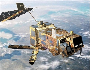
MetOp-A is Europe's first polar-orbiting (LEO) satellite dedicated to operational meteorology. The MetOp program was originally planned as a much larger satellite concept, called POEM (Polar-Orbit Earth-Observation Mission), a successor mission series to ERS-1/2 on the Columbus Polar Platform (PPF design).
However, this idea was abandoned at the ESA Ministerial Council in Granada, Spain, in 1992. Instead, Envisat and MetOp were born. Full approval of the EPS (EUMETSAT Polar System) program was granted in September 1998. The MetOp program is planned as a series of three satellites to be launched sequentially over an observational period of 14 years, starting in 2006 with MetOp-A (2010, 2014), it represents the space segment of EPS. 1) 2)
Copernicus Programme
Copernicus is the European Union's Earth observation programme coordinated and managed by the European Union (EU) in partnership with the European Space Agency (ESA), the EU Member States and EU Agencies.
It aims at achieving a global, continuous, autonomous, high quality, wide range Earth observation capacity. Providing accurate, timely and easily accessible information to, among other things, improve the management of the environment, understand and mitigate the effects of climate change, and ensure civil security.
The objective is to use vast amount of global data from satellites and from ground-based, airborne and seaborne measurement systems to produce timely and quality information, services and knowledge, and to provide autonomous and independent access to information in the domains of environment and security on a global level in order to help service providers, public authorities and other international organizations improve the quality of life for the citizens of Europe. In other words, it pulls together all the information obtained by the Copernicus environmental satellites, air and ground stations and sensors to provide a comprehensive picture of the "health" of Earth.
EPS-SG (programme)
EPS is a programme of Earth observation for Meteorology and weather forecast. The satellite is called METOP. EPS/METOP is managed by the European organisation EUMETSAT. Placed on a polar orbit, the satellite sends picture of the whole Earth.
EPS-SG is the Second Generation of this programme. (respectively the satellite is METOP-SG)
Activities are on-going (Aug. 2012) for the definition of the follow-on EUMETSAT Polar System, to replace the current satellite system in the 2020 timeframe and contribute to the Joint Polar System to be set up with NOAA. Through consultation with users and application experts, requirements have been defined for a range of candidate missions mainly in support of operational meteorology and climate monitoring. A number of on-board instruments, satellite platforms and ground support infrastructure are under study in coordination with ESA, NOAA, DLR and CNES. The satellites will fly, like Metop, in a sun synchronous, low earth orbit at 817 km altitude and 09:30 local time of the descending node, providing observations over the full globe with revisit times of 12 to 24 hours, depending on instrument. Feasibility studies are on-going with the main objective to define the baseline configuration for subsequent detailed design, development and operation programmes to be proposed and coordinated within the involved organisations. Started in 2005 under the name of Post-EPS, the activities will enter in 2012 the design and development phases under a new programme: EPS Second Generation (EPS-SG).
Metop-SG (satellite)
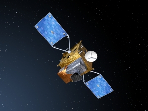
Second generation of European weather satellite series Metop, to provide operational meteo and climate data in the 2020-2040 timeframe from sun-synchronous mid-morning orbit. Also to include GMES Sentinel-5 atmospheric chemistry mission.
Metop-SG is the space segment of the programme EPS-SG of the European organisation Eumetsat.
References:
- The programme: for more details see EPS-SG.
- See also the Metop-SG EO portal.
EUMETSAT
The European Organisation for the Exploitation of Meteorological Satellites (EUMETSAT) is an intergovernmental organisation created through an international convention agreed by a current total of 30 European Member States.
EUMETSAT's primary objective is to establish, maintain and exploit European systems of operational meteorological satellites. EUMETSAT is responsible for the launch and operation of the satellites and for delivering satellite data to end-users as well as contributing to the operational monitoring of climate and the detection of global climate changes.
The activities of EUMETSAT contribute to a global meteorological satellite observing system coordinated with other space-faring nations.
Satellite observations are an essential input to numerical weather prediction systems and also assist the human forecaster in the diagnosis of potentially hazardous weather developments. Of growing importance is the capacity of weather satellites to gather long-term measurements from space in support of climate change studies.
EUMETSAT is not part of the European Union, but became a signatory to the International Charter on Space and Major Disasters in 2012, thus providing for the global charitable use of its space assets.[1]
- public organisation
- Europe
- mission operations
- satellite operator
- meteorology
- Copernicus (EO program)
- Meteosat Third Generation
- Meteosat
- Meteosat Second Generation
- MTG
- MSG
- MTP
- Meteosat Transition Phase
- METOP
- METOP SG
- Sentinel 1
- Sentinel 2 satellite
- Sentinel 2
- Sentinel 3
- Sentinel 4
- sentinel 5P
- sentinel 5
- Sentinel 6
- JasonCS
- Jason 2
- Jason 3
- EPS
- EPS_SG
- NOAA

