
Copernical Team
Space Babes
 Houston, we have a problem! Love and sex need to happen in space if we hope to travel long distances and become an interplanetary species, but space organizations are not ready.
National agencies and private space companies - such as NASA and SpaceX - aim to colonize Mars and send humans into space for long-term missions, but they have yet to address the intimate and sexual needs of astron
 Two astronauts return to ISS after 7-Hour Spacewalk
 Two international astronauts, Japan's Akihiko Hoshide and France's Thomas Pesquet have returned safely to the International Space Station (ISS) after completing a spacewalk that spanned nearly seven hours, NASA said.
"Astronauts Akihiko Hoshide of the Japan Aerospace Exploration Agency (JAXA) and Thomas Pesquet of ESA (European Space Agency) have concluded the first spacewalk conducted by
 Space men at work
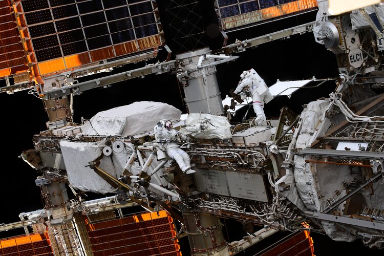 Image:
If you are spacewalking and you know it, raise your hand.
ESA astronaut Thomas Pesquet (left) and JAXA astronaut Aki Hoshide (right) performed a spacewalk on Sunday 12 September to prepare another section of the International Space Station for its solar panel upgrade.
The new solar arrays, called IROSA or ISS Roll-Out Solar Array, are being gradually installed over the existing arrays to boost the International Space Station’s power system.
Thomas and NASA astronaut Shane Kimbrough prepared and installed two IROSA solar panels across three spacewalks in June. The arrays were taken from their storage area outside the Space Station and
There's now a gas station in space

According to the Union of Concerned Scientists (UCS), over 4,000 operational satellites are currently in orbit around Earth. According to some estimates, this number is expected to reach as high as 100,000 by the end of this decade, including telecommunication, internet, research, navigation, and Earth Observation satellites. As part of the commercialization of low Earth orbit (LEO) anticipated in this century, the presence of so many satellites will create new opportunities, as well as hazards.
The presence of these satellites will require a great deal of mitigation to prevent collisions, servicing and maintenance. For example, the San Francisco-based startup Orbit Fab is working to create all the necessary technology for orbital refueling services for satellites. To help realize this goal, industry giant Lockheed Martin recently announced that they are investing in Orbit Fab's "Gas Stations in Space" refueling technology.
The San Francisco-based startup was founded in 2018 by Daniel Faber and Jeremy Schiel, both of whom have strong backgrounds in the commercial space industry. Between 2016 and 2019, Faber was the CEO of Deep Space Industries (DSI), one of the leading companies currently developing asteroid mining capabilities.
Announcing Earth observation hackathon winners

In June 2021, more than 4300 participants from 132 countries and territories came together to solve challenges related to the COVID-19 pandemic. ESA, NASA and the Japan Aerospace Exploration Agency (JAXA) are pleased to announce CleverChart and TRACER as the winners of the Open Science Award.
EXPLAINER: 4 will circle Earth on 1st SpaceX private flight
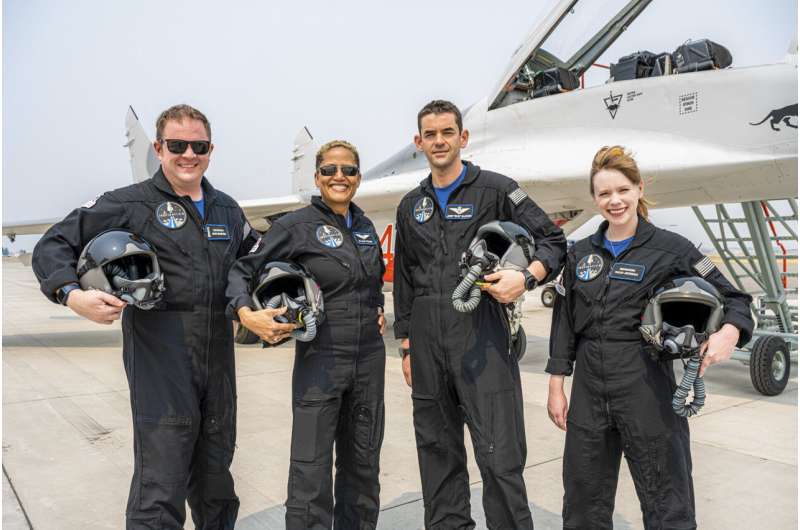
For the first time in 60 years of human spaceflight, a rocket is poised to blast into orbit with no professional astronauts on board, only four tourists.
SpaceX's first private flight will be led by a 38-year-old entrepreneur who's bankrolling the entire trip. He's taking two sweepstakes winners with him on the three-day, round-the-world trip, along with a health care worker who survived childhood cancer.
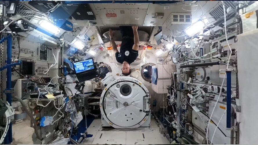
Kibo | Space Station 360 (in French with English subtitles available)
 Video:
00:02:59
ESA astronaut Thomas Pesquet takes you on a tour of the International Space Station like no other. Filmed with a 360 camera, the Space Station 360 series lets you explore for yourself alongside Thomas’s explanation – this is the Kibo module.
Kibo is the Japanese module, also known as the Japanese Experiment Module or JEM. Thomas takes you through the hardware available for the astronauts and researchers on Earth and the unique airlock and storage space in Kibo.
The video is part of a series with Thomas showing each module in full 360 surround video.
Click and drag with your
Cosmic concrete developed from space dust and astronaut blood
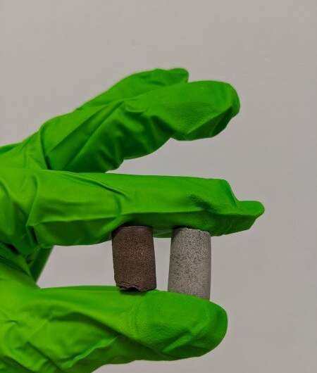
Transporting a single brick to Mars can cost more than a million British pounds—making the future construction of a Martian colony seem prohibitively expensive. Scientists at The University of Manchester have now developed a way to potentially overcome this problem, by creating a concrete-like material made of extra-terrestrial dust along with the blood, sweat and tears of astronauts.
In their study, published today in Materials Today Bio, a protein from human blood, combined with a compound from urine, sweat or tears, could glue together simulated moon or Mars soil to produce a material stronger than ordinary concrete, perfectly suited for construction work in extra-terrestrial environments.
The cost of transporting a single brick to Mars has been estimated at about US$2 million, meaning future Martian colonists cannot bring their building materials with them, but will have to utilize resources they can obtain on-site for construction and shelter. This is known as in-situ resource utilization (or ISRU) and typically focusses on the use of loose rock and Martian soil (known as regolith) and sparse water deposits.
Toward better space health: Understanding the effects of microgravity on P-glycoprotein

Deep space is most likely going to be humanity's final frontier, and space travel will undoubtedly become much more common in the future. However, space is a very hostile environment not only because of the technical difficulties that entail going there, but also because of the detrimental effects that constant microgravity has on the human body. Some examples of these are bone loss, muscle atrophy, and liver and kidney problems, as well as space motion sickness.
It should come as no surprise that astronauts resort to various drugs to ameliorate the symptoms caused by microgravity. Unfortunately for them, microgravity has been noted to have a significant impact on the pharmacokinetics of certain drugs, which could lead to altered efficacy and unexpected outcomes. In particular, delivering an accurate amount of a drug to the brain has become a key problem in space health.
In a recent effort to shed some light onto this issue, a team of scientists from Beijing Institute of Technology, China, studied the effects that microgravity has on P-glycoprotein (P-gp), an important efflux transporter. Their results are detailed in their paper published in Space: Science and Technology, on 17 Jun 2021.
SpaceX Inspiration4 mission will send four people with minimal training into orbit
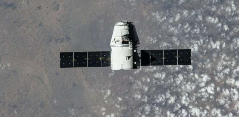
On Sept. 15, 2021, the next batch of space tourists are set to lift off aboard a SpaceX rocket. Organized and funded by entrepreneur Jared Isaacman, the Inspiration4 mission touts itself as "the first all-civilian mission to orbit" and represents a new type of space tourism.
The four crew members will not be the first space tourists this year. In the past few months, the world witnessed billionaires Richard Branson and Jeff Bezos launching themselves and a lucky few others into space on brief suborbital trips.

