Copernical Team
SES Government Solutions releases new unified operational network
 SES Government Solutions has announced its new Common Operational Picture (COP) platform, Hydra, built exclusively to serve the U.S. Government and military. Managed and operated in-house, Hydra is a modular web-based monitoring and control system that provides end-to-end situational awareness in a single unified operational network platform.
Hydra collects, normalizes, and organizes data
 Astra announces launch for NASA from Cape Canaveral in January
 Astra Space, Inc. has announced plans to deploy its first satellite in orbit for NASA in January 2022. The launch from Cape Canaveral will be conducted out of Space Launch Complex 46 (SLC-46) and will be Astra's first launch out of Cape Canaveral.
"This historic launch site has been prepared for a new commercial launch partner in less than year, which is a tremendous milestone for our comb
 Milestone mission for China's first commercial rocket company
 Galactic Energy, a carrier rocket maker in Beijing, has become the first private enterprise in China to have conducted two orbital missions that placed satellites in outer space.
The company's CERES 1 Y2 rocket, the second of its kind, blasted off at 12:12 pm Tuesday at the Jiuquan Satellite Launch Center in Northwest China's Gobi Desert and flew for about 14 minutes before deploying five
 Rocket Lab to launch three dedicated Electron missions for EO firm Synspective
 Rocket Lab USA has signed a deal with Japanese Earth imaging company Synspective to carry out three dedicated Electron launches.
The first two missions are scheduled for lift-off from Rocket Lab Launch Complex 1 in 2022, with a third to follow in 2023. Each mission will deploy a single StriX satellite, growing Synspective's synthetic aperture radar (SAR) constellation developed to deliver
 BlackSky continues operational momentum with two back-to-back launches in six days
 BlackSky plans to add another two satellites to its constellation Wednesday with the Rocket Lab mission titled "A Data with Destiny." Satellites from the SpaceX mission Thursday began delivering revenue-generating insights for customers less than 24 hours following launch and increased constellation revisit rates to six consistent visits per day in key markets during daylight hours.
"Black
 Russian rocket blasts off carrying Japanese billionaire to the ISS
 A Russian rocket lifted off on Wednesday carrying a Japanese billionaire to the International Space Station, marking the country's return to space tourism after a decade-long pause that saw the rise of competition from privately held US companies.
Online fashion tycoon Yusaku Maezawa and his production assistant Yozo Hirano blasted off from the Russia-leased Baikonur cosmodrome in Kazakhstan
 Comet Leonard soon visible to naked eye?

Mirror, mirror, on the Moon
 Image:
Mirror, mirror, on the Moon, how far away are you?
MoonLIGHT or Moon Laser Instrumentation for General relativity/geophysics High-accuracy Tests is seeking the answer to this and more questions on general relativity, the gravitational dynamics of the Earth-Moon system and the deep lunar interior.
MoonLIGHT is a laser retroreflector, imaged here, which allows laser beams sent from Earth to be reflected back from the Moon to receivers on our planet. This allows very precise measurement of the distances between the reflector and the ground station.
Known as lunar laser ranging, this technique has been in use since the Apollo missions to investigate
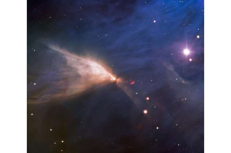
Gemini South telescope catches a one-winged butterfly

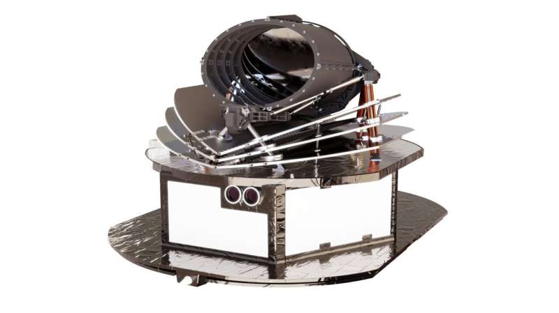
Airbus will build ESA's Ariel exoplanet satellite

ESA and Airbus have signed a contract to move forward with the design and construction of the Atmospheric Remote-sensing Infrared Exoplanet Large-survey, Ariel, planned for launch in 2029.
Ariel is the third in a trio of dedicated exoplanet missions conceived by ESA focusing on various aspects of this rapidly evolving subject area. It will follow Cheops, which launched in 2019, and Plato, scheduled for launch in 2026.
Ariel will study the composition of exoplanets, how they formed and how they evolve, by surveying a diverse sample of about 1000 extrasolar planets, simultaneously in visible and infrared wavelengths.
It is the first mission dedicated to measuring the chemical composition and thermal structures of exoplanets, linking them to the host star's environment. This will fill a significant gap in our knowledge of how the planet's chemistry is linked to the environment where it formed, or if and how the type of host star drives the physics and chemistry of the planet's evolution.
