Copernical Team
Chemical history of the Milky Way revealed by new catalog of tens of millions of stars
 University of Notre Dame researchers, along with collaborators in China and Australia, published a new sample catalog of more than 24 million stars that can be used to decipher the chemical history of elements in the Milky Way Galaxy.
The research, published February 3 in The Astrophysical Journal, represents about one-hundredth of a percent of the roughly 240 billion stars in the Milky Wa
 Is the 'fine-tuned universe' an illusion?
 For decades physicists have been perplexed about why our cosmos appears to have been precisely tuned to foster intelligent life. It is widely thought that if the values of certain physical parameters, such as the masses of elementary particles, were tweaked, even slightly, it would have prevented the formation of the components necessary for life in the universe - including planets, stars, and g
 NASA selects developer for rocket to retrieve first samples from Mars
 NASA has awarded a contract to Lockheed Martin Space of Littleton, Colorado, to build the Mars Ascent Vehicle (MAV), a small, lightweight rocket to launch rock, sediment, and atmospheric samples from the surface of the Red Planet. The award brings NASA a step closer to the first robotic round-trip to bring samples safely to Earth through the Mars Sample Return Program.
"This groundbreaking
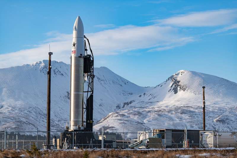
 Astra Space scrubs attempt for 1st Cape Canaveral launch

A new rocket company on the Space Coast looked to make its first launch on a mission for NASA Saturday as Astra Space lined up its Rocket 3 from Cape Canaveral Space Force Station, but an issue on the Eastern Range caused a late scrub at the end of its three-hour launch window.
"Unfortunately due to a range asset that has gone out of service today we are going to stand down from today's launch attempt," said Astra Space Director of Product Management Carolina Grossman. "We're going to give it another try tomorrow."
The company based in Alameda, California, received a new type of launch license from the Federal Aviation Administration on Friday that allows for more frequent launches, and clearing the way for its attempt from Space Launch Complex 46.
The countdown clock had been reset to 3:30 p.m. EST, near the end of its 1-4 p.m. launch window, but the clock was put in a hold at T-15 minutes despite dicey weather and rocket parameters all listed as go for launch.
Video: Space repairs in 360 degrees

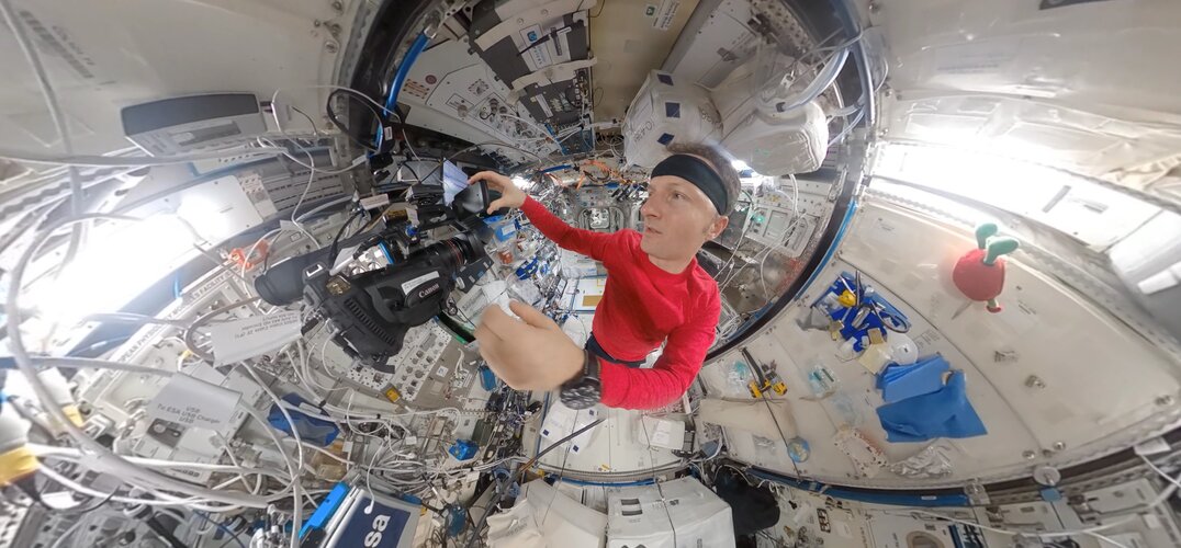
Scientist, engineer, test subject and tradesperson—astronauts in orbit wear many different hats. In this 360° timelapse, ESA astronaut Matthias Maurer works to repair a faulty valve behind EXPRESS-Rack 3.
Water On-Off Valve 8 (WOOV-8), along with WOOV-6 and WOOV-7, determines whether the cooling water of Europe's Columbus module flows through, or bypasses, the heat exchange system that transfers waste heat to downstream cooling circuits outside the International Space Station. The valve has been a problem child for ground teams and astronauts for the past few years and was first replaced during a complicated operation in 2013.
It was last replaced by ESA astronaut Thomas Pesquet in October 2021, but continued issues led Matthias to try out a reserve valve to see if an unplanned conversion was possible. The operation was successfully completed on the real WOOV-8 in December 2021, and all involved breathed a sigh of relief.
Performing maintenance and repair tasks in weightlessness is especially difficult as astronauts have the added challenge of trying to hold themselves in position while turning a screw or securing a hatch.
Space doctors in the virtual house – the sequel

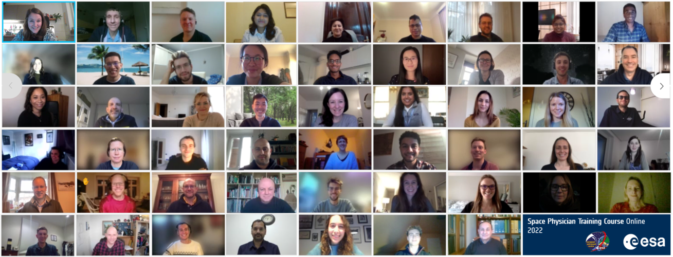
ESA’s second online Space Physician Training Course (SPTC) took place from 18 – 19 January 2022, attracting almost 60 participants from across Europe and the world.
The SPTC is run by ESA’s space medicine team and gives medical doctors the opportunity to learn more about space medicine and supporting astronauts’ health from ESA’s leading experts.
Space repairs in 360° | Cosmic Kiss
 Video:
00:01:25
Scientist, engineer, test subject and tradesperson – astronauts in orbit wear many different hats. In this 360° timelapse, ESA astronaut Matthias Maurer works to repair a faulty valve behind EXPRESS-Rack 3.
Water On-Off Valve 8 (WOOV-8), along with WOOV-6 and WOOV-7, determines whether the cooling water of Europe’s Columbus module flows through, or bypasses, the heat exchange system that transfers waste heat to downstream cooling circuits outside the International Space Station. The valve has been a problem child for ground teams and astronauts for the past few years and was first replaced during a complicated operation in 2013.
New research strengthens link between glaciers and Earth's 'Great Unconformity'
 January 25, 2022 - New research provides further evidence that rocks representing up to a billion years of geological time were carved away by ancient glaciers during the planet's "Snowball Earth" period, according to a study published in Proceedings of the National Academy of Sciences.
The research presents the latest findings in a debate over what caused the Earth's "Great Unconformity"-
 Ancient ice reveals mysterious solar storm
 Through analyzes of ice cores from Greenland and Antarctica, a research team led by Lund University in Sweden has found evidence of an extreme solar storm that occurred about 9,200 years ago. What puzzles the researchers is that the storm took place during one of the sun's more quiet phases - during which it is generally believed our planet is less exposed to such events.
The sun is a prer
 Animal genomes: Chromosomes almost unchanged for over 600 million years
 Animal diversity is fascinating, but how is this reflected in their genetic material, the genome? Is it possible to definitely distinguish animals from one another based on genetic information, and perhaps even make predictions about how genetic information changes over time? This has been the great hope since the beginning of the "genome era" in 2000, when the human genome was sequenced for the
