Deployment won't come until 4.5 hours after launch.
With 5.1 million pounds of thrust at liftoff, Falcon Heavy bested the power of the ULA Atlas V rockets that gave a ride to the previous three GOES satellites.
"This is an incredibly high energy orbit that necessitates an incredibly powerful rocket to get there," said SpaceX's Julianna Scheiman, director of its NASA Science Missions program. She said SpaceX worked with NASA's launch services and Lockheed Martin, which built the GOES satellite, to optimize its propellant over its lifetime.
"The number of years our normal spacecraft specification lifetime is 15 years. With the added capability that the Falcon Heavy is giving us we expect to be 20 plus years of life—fuel life," said NOAA GOES program manager Pam Sullivan.
It's the 19th Geostationary Operational Environmental Satellite (GOES) launched since 1975, but the last of four in the GOES-R series that launched in 2016, 2018 and 2022.
"(GOES-R) ushered in a new and transformative era of advanced Earth monitoring technologies to ever orbit in space," said Steve Volz, assistant administrator for NOAA's Satellite and Information Service. "Our National Weather Service colleagues tell us that this technology has since changed the game for weather prediction."
GOES-U, like the previous 18 GOES satellites, will change names once it reaches space and become GOES-19. It will then spend the next year getting into place in geostationary orbit so it can take over the role and inherit the title of the NOAA's GOES-East satellite. GOES-R, that became GOES-16, currently is tasked with that role, looking at the Atlantic basin.
There's also a GOES-West parked in space looking at the Pacific and a spare GOES satellite in case one of the two were to malfunction.
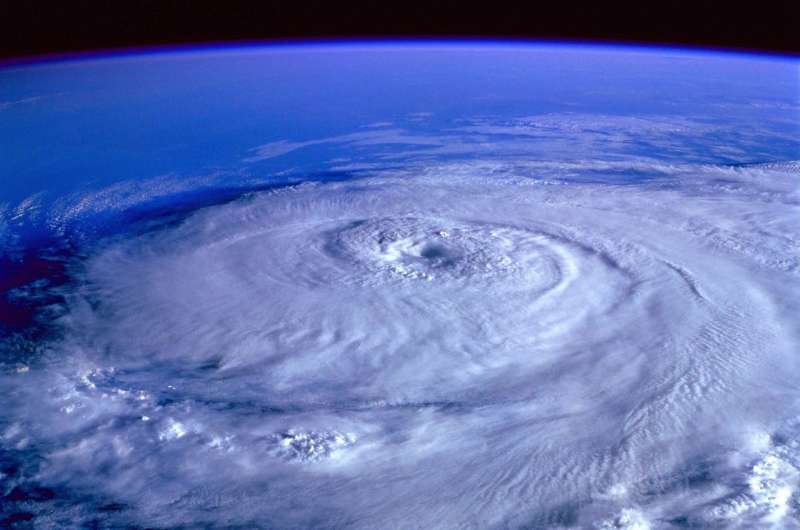
Floridians are used to seeing the end product of the GOES-East satellite as it's the source for satellite images used for tracking tropical storms and hurricanes with its primary camera, the Advanced Baseline Imager built by Melbourne-based L3Harris Technologies. It also helps track thunderstorms, fires, floods and other severe weather across the U.S.
"It'll be looking at the entire Western Hemisphere once every 10 minutes, the entire U.S. every five minutes," Sullivan said. "It's zooming in and doing what we call smaller mesoscale areas as frequently as every 30 seconds."
A second instrument on board built by Lockheed Martin can take up to 500 shots per second "to track lightning to help identify severe storms likely to spawn tornadoes, hail and damaging winds," she said.
A new instrument on board called the compact coronagraph will look away from Earth toward the sun to track coronal mass ejections that can threaten the planet's electrical and communications grids.
National Hurricane Center Director Michael Brennan says live GOES satellite images blanket its headquarters.
"Oh, it's constant. It's always there," he said. We have multiple computer monitors that always have satellite imagery on them. So we're looking at just auto updates of every image—visible, infrared, water vapor. It's constantly there."
He said it's the NHC's first line of defense and invaluable for systems farther out before Hurricane Hunter aircraft can reach them, and the four satellites from the GOES-R series were a huge improvement over the previous series.
"I think when I started as a hurricane forecaster in 2008 … you had much less frequent imagery, much lower resolution. You had eclipse blackouts of imagery around the times of the equinox where you would remember working in the midnight shift, and you would go two or three hours without a satellite picture," he said.
GOES-U is expected to serve as the Atlantic watchdog for at least 10 years. The first replacement for the current stable of satellites, called the Geostationary Extended Observations (GeoXO) satellites, won't come until at least 2032, although Lockheed Martin and L3Harris are on board to work on them as well.
"GeoXO will have advanced instruments that provide an order of magnitude more data," said Sullivan.
That includes more precise tracking of fires and storms, an ocean color sensor to monitor water quality and hazards, and atmospheric sensors to track air pollution and improve weather modeling, she said.
"GEO capabilities will help us address the challenges of a changing planet from more unpredictable weather to more prevalent harmful algal blooms to more widespread wildfires," she said.
Getting some extra fuel stored for the long haul for GOES-U with the Falcon Heavy's power only helps ensure continuity until the GeoXO satellites arrive and keep its watchful eye on weather for years to come, she said.
"We've got that constant view up there and we're really seeing some interesting phenomena that's improving our understanding of weather systems as well as being the day-to-day help that the forecaster needs," Sullivan said.
2024 Orlando Sentinel. Distributed by Tribune Content Agency, LLC.


