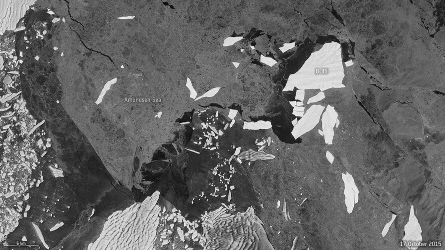
The neural network introduced in this study is highly proficient in identifying the largest iceberg in each image, unlike comparative methods, which frequently select slightly smaller icebergs in proximity.
The architecture of the neural network is based on the renowned U-net design. It was meticulously trained using Sentinel-1 images exhibiting giant icebergs in various settings, with manually-derived outlines serving as the target.
Throughout the training process, the system continually refines its predictions, adjusting its parameters based on the difference between the manually derived outline and the predicted result. Training ceases automatically when the system reaches its optimum performance, ensuring its adaptability and success on new examples.
The algorithm has been tested on seven icebergs, ranging in size from 54 sq km to 1052 sq km, roughly equivalent to the areas of the city of Bern in Switzerland and Hong Kong, respectively.
A diverse dataset was compiled, incorporating between 15 and 46 images for each iceberg, spanning various seasons and the years 2014 –2020.
A single Sentinel-1 image per month per iceberg was used to ensure dataset variety. Presenting an accuracy of 99%, the results have been impressive.
Dr Braakmann-Folgmann added, “Being able to map iceberg extent automatically with enhanced speed and accuracy will enable us to observe changes in iceberg area for several giant icebergs more easily and paves the way for an operational application.”
ESA’s Mark Drinkwater noted, “Satellites are, of course, essential for monitoring changes and understanding processes occurring far from civilisation. This new neural network automates what would otherwise be a manual and labour-intensive task of locating and reporting iceberg extent.
“We congratulate the team on the introduction of this innovative machine learning approach, to achieve a robust and accurate approach to monitoring changes in the vulnerable Antarctic region.”


