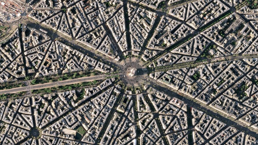
The Arc de Triomphe, or in full Arc de Triomphe de l’Étoile, is an iconic symbol of France and one of the world’s best-known commemorative monuments. The triumphal arch was commissioned by Napoleon I in 1806 to celebrate the military achievements of the French armies. Construction of the arch began the following year, on 15 August (Napoleon’s birthday).
The arch stands at the centre of the Place Charles de Gaulle, the meeting point of 12 grand avenues which form a star (or étoile), which is why it is also referred to as the Arch of Triumph of the Star. The arch is 50 m high and 45 m wide.
The names of all French victories and generals are inscribed on the arch’s inner and outer surfaces, while the Tomb of the Unknown Soldier from World War I lies beneath its vault. The tomb’s flame is rekindled every evening as a symbol of the enduring nature of the commemoration and respect shown to those who have fallen in the name of France.
The Arc de Triomphe’s location at the Place Charles de Gaulle places it at the heart of the capital and the western terminus of the Avenue des Champs-Élysées (visible in the bottom-right of the image). Often referred to as the ‘most beautiful avenue in the world’, the Champs-Élysées is known for its theatres, cafés and luxury shops, as the finish of the Tour de France cycling race, as well as for its annual Bastille Day military parade.
This image, captured on 9 April 2022, was provided by Planet SkySat – a fleet of 21 very high-resolution satellites capable of collecting images multiple times during the day. SkySat’s satellite imagery, with 50 cm spatial resolution, is high enough to focus on areas of great interest, identifying objects such as vehicles and shipping containers.
SkySat data, along with PlanetScope (both owned and operated by Planet Labs), serve numerous commercial and governmental applications. These data are now available through ESA’s Third Party Mission programme – enabling researchers, scientists and companies from around the world the ability to access Planet’s high-frequency, high-resolution satellite data for non-commercial use.
Within this programme, Planet joins more than 50 other missions to add near-daily PlanetScope imagery, 50 cm SkySat imagery, and RapidEye archive data to this global network.
Peggy Fischer, Mission Manager for ESA’s Third Party Missions, commented, “We are very pleased to welcome PlanetScope and SkySat to ESA’s Third Party Missions portfolio and to begin the distribution of the Planet data through the ESA Earthnet Programme.
“The high-resolution and high-frequency imagery from these satellite constellations will provide an invaluable resource for the European R&D and applications community, greatly benefiting research and business opportunities across a wide range of sectors.”
To find out more on how to apply to the Earthnet Programme and get started with Planet data, click here.
The image is also featured on the Earth from Space video programme.


