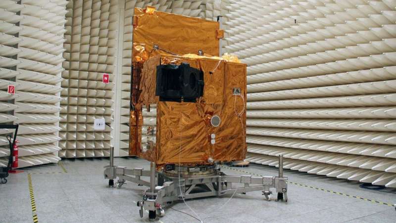
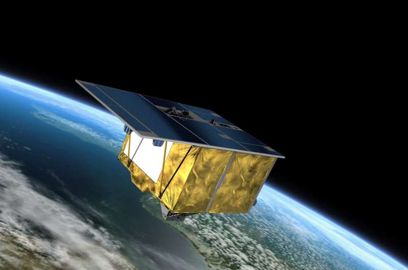
The EnMAP environmental mission is led by the German Space Agency at the German Aerospace Center (DLR) on behalf of the Federal Ministry of Economics and Climate Protection (BMWK). The mission is under the scientific management of the German Research Centre for Geosciences (GFZ) in Potsdam. The satellite and the hyperspectral instrument were developed and built by OHB-System AG. The total cost is around 300 million euros.
Anna Christmann: "The innovative mission helps to record the effects of the climate crisis and environmental pollution"
"Without Earth observation from space, it would be very difficult to quantify the global extent of the climate crisis and its consequences," says the Federal Government Commissioner for Aerospace, MdB Dr. Anna Christmann. "The innovative and powerful EnMAP satellite mission of DLR and GFZ will give us precise information about the state of the Earth's ecosystems with its hyperspectral images. This will help us to record the effects of the climate crisis, biodiversity loss and environmental pollution. With EnMAP, Germany is making an important contribution to European space technology and to an intact planet."

Niels Hovius: "The launch marks a milestone in GFZ history"
The Scientific Director (interim) of the GFZ, Prof. Niels Hovius, emphasizes the scientific importance of the mission and the diverse applications: These ranged "from the exploration of deposits and soil mapping to the monitoring of water quality, the early detection of plant stress and the recording of environmental pollution. EnMAP will provide important data to accurately determine the consequences of climate change and other environmental changes on Earth." Hovius added: "The launch marks a milestone in GFZ history. Colleagues at the GFZ have been working on the mission's research program together with the international EnMAP Science Advisory Group for many years." The Potsdam team is also coordinating the large EnMAP-PI project for the scientific preparation and support of the mission. This includes, among other things, the development of open source software tools for hyperspectral data analysis, the independent validation of EnMAP data, and a wide range of training and networking activities for the user community. EnMAP-PI is jointly supported by the partner institutions Humboldt University Berlin, University of Greifswald, AWI Bremerhaven and LMU Munich.
Manja Schüle: "Forward-looking and indispensable impulses for international geo, environmental and climate research"
Brandenburg's Minister of Research, Dr. Manja Schüle, was pleased with the successful launch and commented: "A completely new view of our Earth: thanks to the EnMAP satellite mission, we will receive even more reliable information about man-made changes and damage to our ecosystems in the future. These are the best prerequisites for developing innovative measures to adapt to climate change. The launch vehicle was launched in Cape Canaveral—the scientific management of the research project is in Potsdam. Once again, the GeoForschungsZentrum is providing such forward-looking and indispensable impulses for international geo, environmental and climate research."

About the EnMAP satellite
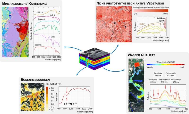
The special cameras on board provide images of the Earth's surface in more than two hundred narrow, contiguous wavelength bands, so-called hyperspectral images or imaging spectroscopy. With these spectrally high-resolution data, the Earth can be observed in a previously unattained level of detail. Minerals or pollutants can be detected and identified, plants can be determined and their nutrient supply monitored, or the degree of pollution of bodies of water can be detected.


