


For the first time in a published Mars atlas, climate maps are included, which show 13 climatic zones with boundaries defined by combining seasonal temperature and frost data. A series of climate diagrams show the variation in temperature through the martian year for each of the zones. In addition, a weather map shows the temperature at ground level across the western hemisphere of Mars at the two annual solstices.
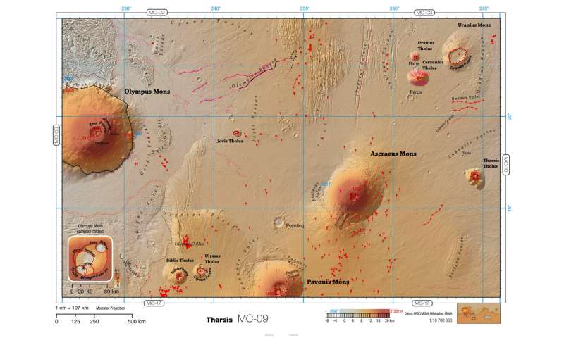
Double spread of thematic map of Tharsis region of Mars (Mars Chart 09) from the Pocket Atlas of Mars 36. The scale of the map is 1cm=107 km. Credit: NASA/JPL/GSFC/ESA/DLR/FU/H. Hargitai 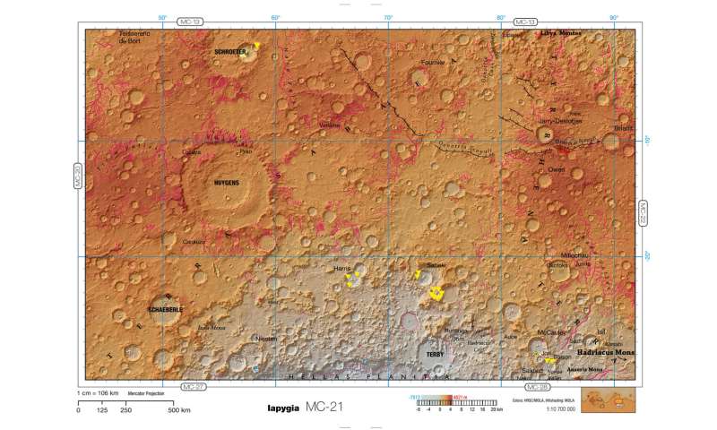
Double spread of thematic map of Iapygia region of Mars (Mars Chart 21) from the Pocket Atlas of Mars 36. The scale of the map is 1cm=106 km. Credit: NASA/JPL/GSFC/ESA/DLR/FU/H. Hargitai
The atlas also includes an albedo map, derived from data from Mars Express and Mars Global Surveyor, which shows the amount of sunlight reflected from the surface, the frequently cloudy regions and the maximum area covered by the seasonal caps of frozen carbon dioxide and water ice at the martian poles.
The map editor, Henrik Hargitai of the Eötvös Loránd University, Budapest and former chair of the Commission on Planetary Cartography of the International Cartographic Association, said: "The maps in the atlas are manually edited, using accurate data from missions and models. Thematic maps that reveal patterns in physical geography have been used for decades for in terrestrial atlases, but this is the first time that they are available in an atlas for Mars. The publication of this edition is a culmination of mapping efforts over the last two decades. The atlas also includes a one-page calendar for Mars year 36, covering the period from February 2021 to December 2022, which explains the milestones in the seasonal changes on Mars."

Future plans for the atlas include the addition of themed maps that show regions of interest in detail, and atlas-based activities for educators. As well as being a tool for outreach and education, this type of multi-themed map could be valuable for the scientific community in interpreting the geologic evolution of Mars, estimating whether an area might ever have hosted life, or identifying in-situ resources to support future human exploration missions.