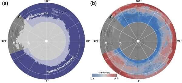
The project, aptly named the Subsurface Water Ice Mapping (SWIM) of Mars project, focused on a region of the northern hemisphere slightly outside the "ice stabilization zone" that exists above 50 degree latitude in the northern hemisphere. In this zone, the temperatures are cold enough that the ice is most likely stable at the current environmental conditions on Mars.
At these latitudes, the sunlight available to any human mission would be too low to power the necessary life sustaining technology, making it unsuitable for a human landing spot. Farther south, the sun's power increases significantly, making it possible to power life support with solar power in these regions. While SWIM didn't cover the entire northern hemisphere outside of the polar region, it did cover most.
It did so using data from three different sources: the Mars Reconnaissance Orbiter, Mars Odyssey, and Mars Global Surveyor orbiting satellites. Five different types of data from these satellites were fed into a novel data processing algorithm to stitch them together to come up with a fully realized "ice consistency map." These data types included thermal analysis, radar subsurface compositional (dielectric) analysis, geomorphic mapping of periglacial (i.e. area around a glacier or ice sheet) features, neutron spectroscopy, and radar surface analysis.
Even with that abundance of different data sources, the PSI team is still quick to point out that the level of detail completed in this first study is not suitable for selecting a landing site for a future Mars mission. Luckily any such mission is still in the early conceptual stages, so the team has time to study areas of interest in the hemisphere more carefully, and collect further data to build more detailed models of particularly interesting spots.

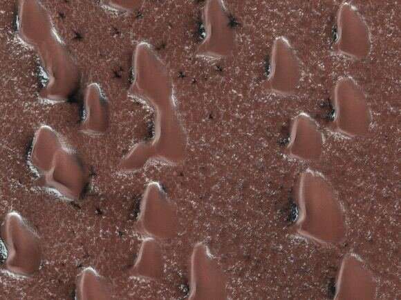
The first signs of Spring in the northern polar ice cap on Mars: fans of dust launched by sublimating gas. Credit: NASA/JPL/UArizona 
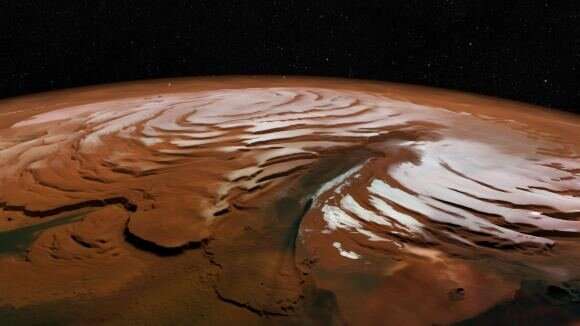
A vertically exaggerated view of Mars’ north polar cap. Researchers with The University of Texas at Austin and the University of Arizona estimate that if melted, the massive ice deposits discovered in this region would cover the planet in 1.5 meters (5 feet) of water. Credit: SA/DLR/FU Berlin; NASA MGS MOLA Science Team
That is exactly what they plan to do—the next step of the SWIM project is to both further analyze existing data and collect new data on these sites of interest. With any luck, before any future Mars mission plan moves ahead, they will have a nice detailed ice map of the surface of the northern hemisphere to help choose a landing site.


