Displaying items by tag: Earth observation
MISR
The Multi-angle Imaging SpectroRadiometer (MISR) is a scientific instrument on the Terra satellite launched by NASA on December 18, 1999. This device is designed to measure the intensity of solar radiation reflected by the Earth system (planetary surface and atmosphere) in various directions and spectral bands; it became operational in February 2000. Data generated by this sensor have been proven useful in a variety of applications including atmospheric sciences, climatology and monitoring terrestrial processes.
The MISR instrument consists of an innovative configuration of nine separate digital cameras that gather data in four different spectral bands of the solar spectrum. One camera points toward the nadir, while the others provide forward and aftward view angles at 26.1°, 45.6°, 60.0°, and 70.5°. As the instrument flies overhead, each region of the Earth's surface is successively imaged by all nine cameras in each of four wavelengths (blue, green, red, and near-infrared).
The data gathered by MISR are useful in climatological studies concerning the disposition of the solar radiation flux in the Earth's system. MISR is specifically designed to monitor the monthly, seasonal, and long-term trends of atmospheric aerosol particle concentrations including those formed by natural sources and by human activities, upper air winds and cloud cover, type, height, as well as the characterization of land surface properties, including the structure of vegetation canopies, the distribution of land cover types, or the properties of snow and ice fields, amongst many other biogeophysical variables.
SMOS
SMOS — the second Earth Explorer mission launched on November 2009 designed to measure Soil Moisture and Ocean Salinity.
The Soil Moisture and Ocean Salinity Satellite (SMOS) is a part of ESA's Living Planet Programme intended to provide new insights into Earth's water cycle and climate. In addition, it will provide better weather forecasting and will also monitor snow and ice accumulation.
GOCE
A mission designed to measure the Earth's gravity field, launched on march 2009.
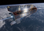
The Gravity Field and Steady-State Ocean Circulation Explorer (GOCE) is an ESA satellite that was launched on March 17, 2009. It is a satellite carrying a highly sensitive gravity gradiometer which detects fine density differences in the crust and oceans of the Earth.
GOCE data will have many uses, probing hazardous volcanic regions and bringing new insight into ocean behaviour. The latter, in particular, is a major driver for the mission. By combining the gravity data with information about sea surface height gathered by other satellite altimeters, scientists will be able to track the direction and speed of geostrophic ocean currents. The low orbit and high accuracy of the system will greatly improve the known accuracy and spatial resolution of the geoid (the theoretical surface of equal gravitational potential on the Earth).
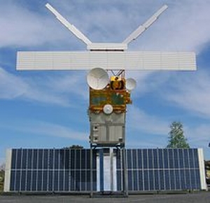
The satellite's arrow shape and fins help keep the GOCE stable as it flies through the wisps of air still present at an altitude of 260 km. In addition, an ion propulsion system continuously compensates for the deceleration of air-drag without the vibration of a conventional chemically-powered rocket engine, thus restoring the path of the craft as closely as possible to a purely inertial trajectory. The craft's primary instrument is three pairs of highly sensitive accelerometers which measure gravitational gradients along three different axes.
CryoSat-2
CryoSat is an ESA programme which will monitor variations in the extent and thickness of polar ice through use of a satellite in low Earth orbit. The information provided about the behaviour of coastal glaciers that drain thinning ice sheets will be key to better predictions of future sea-level rise.
The CryoSat-1 spacecraft was lost in a launch failure in 2005, however the programme was resumed with the successful launch of a replacement, CryoSat-2, launched on 8 April 2010.
CryoSat-2 is a European Space Agency environmental research satellite which was launched in April 2010. It provides scientists with data about the polar ice caps and tracks changes in the thickness of the ice with a resolution of about 1⁄2 inches (1.3 cm). This information is useful for monitoring climate change. Cryosat 2 was built as a replacement for CryoSat-1, whose Rokot carrier rocket was unable to achieve orbit. ESA built a replacement, with software upgrades and greater battery capacity, which carries an interferometric radar range-finder with twin antennas which measures the height difference between floating ice and open water. CryoSat-2 is operated as part of the CryoSat programme to study the Earth's polar ice caps, which is itself part of the Living Planet programme. The CryoSat-2 spacecraft was constructed by EADS Astrium, and was launched by ISC Kosmotras, using a Dnepr-1 carrier rocket, on 8 April 2010. On 22 October 2010, CryoSat-2 was declared operational following six months of on-orbit testing.
CryoSat-2 is operated from the European Space Operations Centre (ESOC) in Darmstadt, Germany.
Envisat
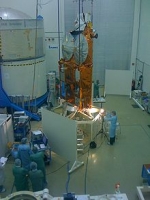
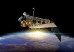
Envisat ("Environmental Satellite") is an Earth observation satellite. Its objective is to service the continuity of European Remote-Sensing Satellite missions, providing additional observational parameters to improve environmental studies.
In working towards the global and regional objectives of the mission, numerous scientific disciplines use the data acquired from the different sensors on the satellite, to study such things as atmospheric chemistry, ozone depletion, biological oceanography, ocean temperature and colour, wind waves, hydrology (humidity, floods), agriculture and arboriculture, natural hazards, digital elevation modelling (using interferometry), monitoring of maritime traffic, atmospheric dispersion modelling (pollution), cartographyand study of snow and ice.
It was launched on 1 March 2002 aboard an Ariane 5 from the Guyana Space Centre in Kourou, French Guyana into a Sun synchronous polar orbit at an altitude of 790 km (490 mi) (± 10 km (6.2 mi)). It orbits the Earth in about 101 minutes with a repeat cycle of 35 days.
Envisat is the largest earth observation satellite put into space (as of late 2006), being 26 m (85 ft) × 10 m (33 ft) × 5 m (16 ft) and having a mass of 8.5 t (8.4 long tons; 9.4 short tons).
The Envisat mission ended on 08 April 2012, following the unexpected loss of contact with the satellite.
Envisat data collectively provide a wealth of information on the workings of the Earth system, including insights into factors contributing to climate change.
THEMIS (ARTEMIS)
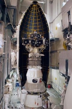
The Time History of Events and Macroscale Interactions during Substorms (THEMIS) mission was originally a constellation of five NASA satellites to study energy releases from Earth's magnetosphere known as substorms, magnetic phenomena that intensify auroras near Earth's poles. The name of the mission is an acronym alluding to the Titan, Themis.
Now three of the original satellites remain in the magnetosphere, while two have been moved into orbit near the Moon. Those two have been renamed ARTEMIS for Acceleration, Reconnection, Turbulence and Electrodynamics of the Moon’s Interaction with the Sun, but are also called ARTEMIS P1 (THEMIS B) and ARTEMIS P2 (THEMIS C).
The THEMIS satellites were launched February 17, 2007 from Cape Canaveral Air Force Station Space Launch Complex 17 aboard a Delta II rocket. Each satellite carries identical instrumentation, including a fluxgate magnetometer (FGM), an electrostatic analyzer (ESA), a solid state telescope (SST), a search-coil magnetometer (SCM) and an electric field instrument (EFI). Each has a mass of 126 kg, including 49 kg of fuel.
Launch date 2007-02-17 23:01:00 UTC
Metop
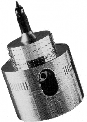
MetOp is a series of three polar orbiting meteorological satellites operated by EUMETSAT, the European Organisation for the Exploitation of Meteorological Satellites.
The satellites form the space segment component of the overall EUMETSAT Polar System (EPS), which in turn is the European half of the EUMETSAT/NOAA Initial Joint Polar System (IJPS). The satellites carry a payload comprising 11 scientific instruments and two which support Search and Rescue services. In order to provide data continuity between MetOp and NOAA Polar Operational Satellites (POES), several instruments are carried on both fleets of satellites.
Meteosat
The Meteosat series of satellites are geostationary meteorological satellites operated by the Euopean organisation EUMETSAT.
SPOT
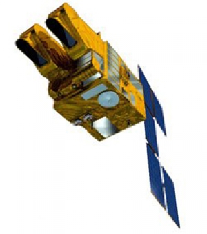
SPOT (Satellite Pour l’Observation de la Terre, lit. "Satellite for Earth Observation") is a high-resolution, optical imaging Earth observation satellite system operating from space. It is run by Spot Image based in Toulouse, France. It was initiated by the CNES (Centre national d'études spatiales — the French space agency) in the 1970s.
ERS - European Remote Sensing satellite
The European remote sensing satellite (ERS) was the European Space Agency's first Earth-observing satellite, injected into a Sun-synchronous polar orbit at a height of 782–785 km.
ERS-1 and ERS–2 were launched into the same orbit in 1991 and 1995 respectively. Their payloads included a synthetic aperture imaging radar, radar altimeter and instruments to measure ocean surface temperature and wind fields.
ERS-2 added an additional sensor for atmospheric ozone monitoring. The two satellites acquired a combined data set extending over two decades.

