Copernical Team
Black hole merger delivers strongest confirmation yet of Einstein and Hawking predictions
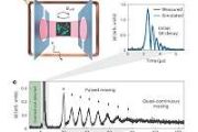
 A decade after scientists first detected gravitational waves, researchers have now recorded the clearest evidence yet of how black holes behave, confirming foundational predictions from Albert Einstein and Stephen Hawking. The findings stem from a black hole merger observed by the Laser Interferometer Gravitational-Wave Observatory (LIGO) and analyzed by astrophysicists Maximiliano Isi and Will
 Methane gas revealed on dwarf planet Makemake by JWST observations
 A Southwest Research Institute-led research team has made the first detection of gas on Makemake, a distant dwarf planet in the outer Solar System, using NASA's James Webb Space Telescope (JWST). The discovery marks Makemake as only the second trans-Neptunian object after Pluto to show confirmed gaseous emissions, identified as methane.
"Makemake is one of the largest and brightest icy wor
 Researchers uncover potential biosignatures on Mars
 A new study co-authored by Texas A and M University geologist Dr. Michael Tice has revealed potential chemical signatures of ancient Martian microbial life in rocks examined by NASA's Perseverance rover.
The findings, published by a large international team of scientists, focus on a region of Jezero Crater known as the Bright Angel formation - a name chosen from locations in Grand Canyon N
 'Potential biosignatures' found in ancient Mars lake
 Led by NASA and featuring key analysis from Imperial College London, the work has uncovered a range of minerals and organic matter in Martian rocks that point to an ancient history of habitable conditions and potential biological processes on the Red Planet.
 Perseverance Meets the Megabreccia
 Last week, the Perseverance rover began an exciting new journey. Driving northwest of the Soroya ridge, Perseverance entered an area filled with a diverse range of boulders that the science team believes could hold clues to Mars' early history.
The terrain we are exploring is known as megabreccia: a chaotic mixture of broken rock fragments likely produced during ancient asteroid impacts. S
 NASA Uses Colorado Mountains for Simulated Artemis Moon Landing Course
 NASA has certified a new lander flight training course using helicopters, marking a key milestone in crew training for Artemis missions to the Moon. Through Artemis, NASA explore the lunar South Pole, paving the way for human exploration farther into the solar system, including Mars.
The mountains in northern Colorado offer similar visual illusions and flight environments to the Moon. NASA
 Finding safe impact zones to deflect hazardous asteroids
 Selecting the point of impact for a kinetic deflection mission is not trivial, according to research unveiled at the EPSC-DPS2025 Joint Meeting in Helsinki. Striking the wrong location could nudge a hazardous asteroid through a gravitational keyhole and set up a future Earth encounter.
"Even if we intentionally push an asteroid away from Earth with a space mission, we must make sure it doe
 Clues to ancient Martian chemistry revealed by Perseverance rover
 NASA's Perseverance rover has uncovered evidence of long-ago chemical processes while exploring Jezero Crater, giving scientists fresh insight into how minerals, water, and possibly organics interacted billions of years ago. A new Nature News and Views article by SETI Institute Senior Research Scientist Janice Bishop and University of Massachusetts Professor Mario Parente highlights these discov
 Chinese astronauts expand science research on orbiting space station
 Shenzhou 20 astronauts - Chen Dong, Chen Zhongrui and Wang Jie - are pushing forward with wide-ranging scientific experiments and technology tests aboard China's space station, advancing knowledge across multiple research domains.
In space medicine, the crew used electroencephalogram equipment for experiments including visual field studies, executive-function training and exploratory utili
 Exolaunch to deliver 59 satellites on record Transporter-15 mission
 Exolaunch will deploy 59 satellites on the upcoming Transporter-15 rideshare flight with SpaceX, scheduled no earlier than November 2025. The mission, Exolaunch's largest to date, spans more than 30 customers across 16 countries, underscoring the company's role as a premier launch services provider with a proven record of reliability.
Transporter-15 highlights Exolaunch's expanding market


