

Copernical Team
China recruits new reserve astronauts, open to those from Hong Kong, Macao
China to provide training for foreign astronauts
 The China Manned Space Agency is doing preparatory work for the training of foreign astronauts to fly aboard the nation's Tiangong space station, said Ji Qiming, assistant director of the agency.
Ji said several nations have expressed to China their wish to send their astronauts to the Tiangong station.
"China is negotiating with relevant parties on this matter. We are actively prepa
The China Manned Space Agency is doing preparatory work for the training of foreign astronauts to fly aboard the nation's Tiangong space station, said Ji Qiming, assistant director of the agency.
Ji said several nations have expressed to China their wish to send their astronauts to the Tiangong station.
"China is negotiating with relevant parties on this matter. We are actively prepa China to launch Shenzhou XV on Tuesday
 China will launch the three astronauts of the Shenzhou XV mission to the space station on Tuesday night, according to a program official.
Ji Qiming, assistant director of the China Manned Space Agency, said at a news conference on Monday morning at the Jiuquan Satellite Launch Center in northwestern China that the crew members - Major General Fei Junlong, Senior Colonel Deng Qingming and S
China will launch the three astronauts of the Shenzhou XV mission to the space station on Tuesday night, according to a program official.
Ji Qiming, assistant director of the China Manned Space Agency, said at a news conference on Monday morning at the Jiuquan Satellite Launch Center in northwestern China that the crew members - Major General Fei Junlong, Senior Colonel Deng Qingming and S IAU CPS Statement on BlueWalker 3
 The International Astronomical Union Center for the Protection of the Dark and Quiet Sky from Satellite Constellation Interference expresses concern about the recently launched prototype BlueWalker 3 satellite's impact on astronomy. New measurements reveal that this low Earth orbiting satellite is now one of the brightest objects in the night sky, outshining all but the brightest stars. In addit
 NASA Orion capsule reaches farthest distance from Earth in lunar orbit
 NASA's Orion space capsule reached its farthest distance from Earth on Monday and successfully completed the first half of a mission that aims to ultimately return American astronauts to the moon.
"Just over an hour ago, Orion set another record clocking its maximum distance from Earth at 270,000 miles," NASA Administrator Bill Nelson announced at 5 p.m. EST on Monday from Johnson Space Ce
NASA's Orion space capsule reached its farthest distance from Earth on Monday and successfully completed the first half of a mission that aims to ultimately return American astronauts to the moon.
"Just over an hour ago, Orion set another record clocking its maximum distance from Earth at 270,000 miles," NASA Administrator Bill Nelson announced at 5 p.m. EST on Monday from Johnson Space Ce Glacier calving and a whole lot of mixing
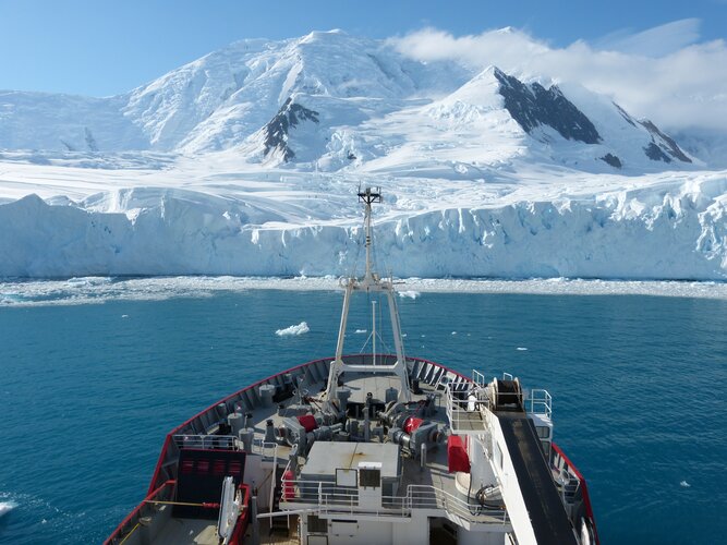
It’s no surprise that when a massive lump of ice drops off the edge of a glacier into the sea, the surface waters of the ocean get pretty churned up. However, in addition to causing tsunamis at the surface of the ocean, recent research has led to the discovery that glacier calving can excite vigorous internal tsunami waves – a process that has been neglected in driving ocean mixing in computer models.
NASA's Lunar Flashlight SmallSat readies for launch

When NASA's Lunar Flashlight launches no earlier than Nov. 30, the tiny satellite will begin a three-month journey, with mission navigators guiding the spacecraft far past the moon. It will then be slowly pulled back by gravity from Earth and the sun before settling into a wide science-gathering orbit to hunt for surface water ice inside dark regions on the moon that haven't seen sunlight in billions of years.
No larger than a briefcase, Lunar Flashlight will use a reflectometer equipped with four lasers that emit near-infrared light in wavelengths readily absorbed by surface water ice. This is the first time that multiple colored lasers will be used to seek out ice inside these dark craters.
3D radargram brings new focus to Mars' north polar cap
 and two opposing vertical slices through the north polar cap of Mars as seen by the MRO radar sounder. The black circle in the middle is centered on the north pole with a diameter of 300 kilometers and represents an area that the radar does not see from MRO’s orbit. Scales vary in this view, which shows the upper 2 kilometers of the 1200-kilometer-wide Planum Boreum at a vertical exaggeration of 150:1. Credit: PSI/ASI/JPL/NASA.")
What happened to those CubeSats that were launched with Artemis I?

NASA made history on November 16 when the Artemis I mission took off from Launch Complex 39B at Cape Canaveral, Florida, on its way to the moon. This uncrewed mission is testing the capabilities of the Space Launch System (SLS) and Orion spacecraft in preparation for the long-awaited return to the moon in 2025 (the Artemis III mission).
The first SLS launch caused damage to the launch pad. How bad was it?

When you test launch the most powerful rocket ever successfully flown, there's bound to be some collateral damage. With 8.8 million pounds of thrust at liftoff, NASA's Space Launch System (SLS) packs a mighty punch (the Saturn V, which carried astronauts to the moon in 1969, produced 7.5 million pounds). After November 16's test flight of SLS, dubbed Artemis I, the pad was a little worse for wear, but not outside of expected parameters, NASA officials say.
"The damage that we did see pertain to really just a couple areas on the 'Zero Deck,'" said Mike Sarafin, Artemis I's mission manager, at a press conference on November 21, referring to the section of the Mobile Launcher Platform that bears the brunt of the rocket engines at liftoff.