Copernical Team
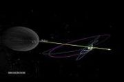
An instrument to be launched into space will reveal ionic details of the heliosphere
This request seems a bit unusual, so we need to confirm that you're human. Please press and hold the button until it turns completely green. Thank you for your cooperation!
Press and hold the button
If you believe this is an error, please contact our support team.
185.132.36.159 : cd6cdcc3-a683-4e88-af4f-b968b470
India, Poland, Hungary make spaceflight comeback with ISS mission
This request seems a bit unusual, so we need to confirm that you're human. Please press and hold the button until it turns completely green. Thank you for your cooperation!
Press and hold the button
If you believe this is an error, please contact our support team.
185.132.36.159 : 254a4b36-846f-47f7-aa36-2a188296
Living Planet Symposium Extra News: Day 2

ESA’s week-long Living Planet Symposium is in full swing in Vienna, Austria, drawing scientists and researchers from around the world. This flagship event focuses on the latest breakthroughs in Earth science and highlights the advanced space technologies used to observe and understand our changing planet. Throughout the week, we’ll be covering the bigger stories in depth, but we’re also sharing some daily snapshots of other significant happenings.
The major highlight of today was the signing of a landmark agreement between ESA and the Ramsar Convention on Wetlands.
SpaceX Starship prototype explodes during ground test in Texas
This request seems a bit unusual, so we need to confirm that you're human. Please press and hold the button until it turns completely green. Thank you for your cooperation!
Press and hold the button
If you believe this is an error, please contact our support team.
185.132.36.159 : a47004e4-2e66-4cc2-83d5-5618bad9
Construction on Mars takes a leap forward
This request seems a bit unusual, so we need to confirm that you're human. Please press and hold the button until it turns completely green. Thank you for your cooperation!
Press and hold the button
If you believe this is an error, please contact our support team.
185.132.36.159 : 96ca37fd-1f64-40ba-afa4-35fb9eea
North Atlantic’s volcanic secrets – it’s about being thin

Iceland is one of the most active volcanic regions in the world, but its seismic nature is part of a much broader geological history.
In a groundbreaking discovery, scientists, supported by an ESA-funded project, have uncovered the underlying forces that forged the North Atlantic’s fiery volcanic past – shedding light on the vast geological region that spans from Greenland to western Europe, which is home to iconic natural wonders like the Giant’s Causeway in Northern Ireland.
Japanese company blames laser tool for its 2nd crash landing on the moon
This request seems a bit unusual, so we need to confirm that you're human. Please press and hold the button until it turns completely green. Thank you for your cooperation!
Press and hold the button
If you believe this is an error, please contact our support team.
185.132.36.159 : e7495e8e-abea-4f36-a360-d85f7276
Living Planet Symposium Extra News: Day 1

ESA’s week-long Living Planet Symposium kicked off today in Vienna, Austria, bringing together scientists and researchers from around the globe. Throughout the week, we’ll be covering the bigger stories in depth, such as the first images from ESA’s Biomass mission published earlier today – but we’re also sharing some daily snapshots of other significant happenings.
So, today’s few ‘extras’ include Sentinel-2 marking 10 years in orbit, ESA selects Telespazio to run the ground segment for the TRUTHS mission and listen to EarthCARE data transformed into a dragon’s song for peace.
Sea ice lows high on the agenda

Satellite observations reveal that the extent of sea ice in the Arctic is once again hovering near record lows for this time of year – underscoring a troubling and persistent trend. This issue is a key topic at ESA’s Living Planet Symposium in Vienna, where scientists are emphasising the critical role that ESA’s Climate Change Initiative Sea Ice Project and CryoSat mission have had in helping to underpin these findings.
Looking ahead, the ability to monitor polar sea ice is in safe hands, as the development of the new CRISTAL mission is progressing well
Globalstar expands wildfire safety tools with Technosylva satellite tech
 Globalstar (NASDAQ: GSAT) has announced further international deployment of its satellite-enabled technologies through an expanding partnership with Technosylva, a specialist in wildfire modeling and risk management. This collaboration continues to equip firefighting agencies with real-time situational tools that enhance safety and response coordination in extreme conditions.
One of the mo


