Copernical Team
NASA's Artemis II plans to send a crew around the moon to test equipment and lay the groundwork for a future landing
Verifying that you are not a bot
NASA's Crew-12 begins quarantine before February launch to space station
Verifying that you are not a bot
SpaceX grounds Falcon 9 missions, could impact ISS launch
Verifying that you are not a bot
NASA targets a March launch of the moon rocket after test run reveals fuel leaks
Verifying that you are not a bot
We ate space mushrooms and survived to tell the tale
Verifying that you are not a bot
NASA moon mission launch delayed to March after test
Verifying that you are not a bot
Moving satellites to meet a plane for rare reentry data

When satellites eventually fall back down to Earth, they mostly burn up because of the friction caused by the atmosphere. Scientific data about this atmospheric reentry process is urgently needed to design future satellites for a quick, safe and sustainable demise at the end of their mission – reducing risks on the ground and in space.
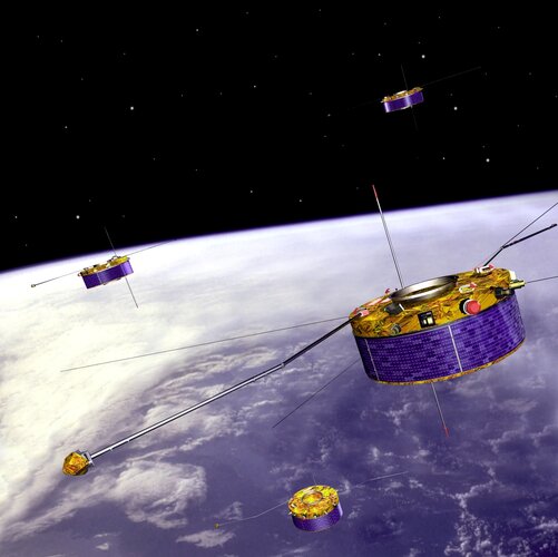
The European Space Agency (ESA) successfully manoeuvred its remaining two Cluster satellites to ensure they can both be observed from a plane as they reenter the atmosphere on 31 August and 1 September 2026.
ESA's sustainability ambition
 Video:
00:04:21
Space activities are unlike any others. They interact not just with Earth, but with three interconnected environments: Earth, Earth’s orbit, and the Moon and deep space. On Earth, we aim to reduce the space sector’s environmental impacts while maximising the societal and environmental benefits of our missions. In orbit, we manage space debris and collision risks to maintain safe and secure operations. For the Moon and deep space, we are laying the foundations to minimise the impact of our missions on and around other celestial bodies.
Guided by our core values, ESA is committed to making its activities
NASA hit by fuel leaks during a practice countdown of the moon rocket that will fly with astronauts
Verifying that you are not a bot
MDA Space and Hanwha target Korean K-LEO defense network
 MDA Space has signed a Memorandum of Understanding with Hanwha Systems to pursue collaboration on Korea's planned sovereign Low Earth Orbit K-LEO defense constellation, targeting enhanced military communications and data services for national security operations. The agreement sets a framework for the two companies to explore how MDA Space's AURORA software-defined digital satellite platform can


