Copernical Team
SpaceX launches 28 Starlink satellites from Cape Canaveral
 SpaceX launched 28 Starlink satellites from Florida on Wednesday morning.
The Falcon 9 rocket lifted off from the Cape Canaveral Space Force Station at 7:56 a.m. EDT.
No sonic booms were heard from the launch.
The booster, on its 14th flight, landed on the drone ship "A Shortfall of Gravitas" in the Atlantic Ocean at 8:04 a.m.
The launch took place after SpaceX laun
 Second MTG-Imager satellite passes thermal vacuum test

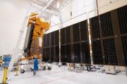
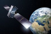
The second of the Meteosat Third Generation Imagers, MTG-I2, has passed some important milestones in the cleanroom facilities at Thales Alenia Space in Cannes, southern France.
Live demonstration shows reliable satellite-5G connectivity on the move

Making video calls while travelling – or when faced with an unstable internet connection – just got easier, thanks to a technology that allows devices to seamlessly bond satellite and ground connections. The European Space Agency (ESA) recently partnered with British advanced networking technology company UniVirtua to conduct a live demonstration of the dashAlpha platform, which could be used to uninterruptedly connect vehicles essential to disaster relief as well as self-driving cars.
Bulgaria won't probe suspected Russian GPS jamming of EU chief plane: PM
 Bulgaria will not open an investigation into the GPS jamming that hit a plane carrying EU chief chief Ursula von der Leyen as it readied to land in the Balkan nation, its prime minister said Tuesday.
The European Commission said on Monday that Bulgarian authorities believed Moscow was responsible for the weekend incident but it was not clear whether the aircraft was deliberately targeted as
 Scientists track lightning "pollution" in real time using NASA satellite
 Picture this: You're stuck in traffic on a summer afternoon, checking the weather app on your phone as dark storm clouds roll in. You might think about power outages or possible flooding, but you probably don't think about how every lightning bolt that flashes across the sky also emits a gas, nitrogen oxide (NO), that is also emitted in the exhaust from your car's engine.
Yet, that's exact
 NASA Scientists Map Plant Productivity with Data from Ocean Satellite
 NASA scientists have developed a new set of tools to monitor plant growth under various conditions throughout the growing season. The hope is that land managers could use these tools to detect sudden drops in plant productivity and to respond earlier to events like heat stress, droughts, and cold snaps.
Monitoring the productivity, or how efficiently plants are producing energy through pho
 Metop SGA1 begins delivering atmospheric data weeks after launch
 Less than three weeks after its 13 August launch, the Metop Second Generation A1 (Metop-SGA1) satellite is already transmitting data from two of its six instruments. Early readings from the Microwave Sounder (MWS) and the Radio Occultation Sounder (RO) mark the beginning of a new era in European meteorological and climate monitoring.
Metop-SGA1 is the first satellite in the EUMETSAT Polar
 MSBAI wins DoD contract to accelerate OrbitGuard for space situational awareness
 MSBAI (Microsurgeonbot Inc.) has received a Direct-to-Phase II SBIR contract worth $1.2 million to advance its OrbitGuard hybrid-intelligence system for space domain awareness. The Department of Defense CDAO originated the opportunity, with selection by the Office of the Secretary of Defense and execution by the Air Force Digital Transformation Office. The 18-month effort positions OrbitGuard fo
 A robotic real-time strategy game in space
 Image:
NASA astronaut Jonny Kim operates European robots from the International Space Station
 ESA Open Days 2025

ESA Open Days 2025
Your chance to meet the European Space Agency


