
Copernical Team
Space helps everyone stay connected

Keeping connected always to everyone and everything whether in remote areas or travelling by car, boat or plane is crucial in today’s digital world.

Aurora over Wales
 Image:
Aurora over Wales
Image:
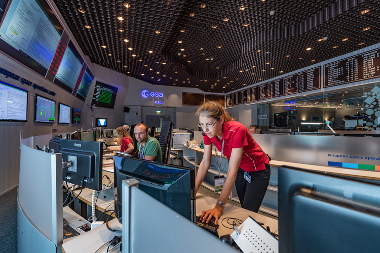
Aurora over Wales #SocialSpace: Apply to join Juice launch at ESA mission control
Antarctic Peninsula glaciers on the run
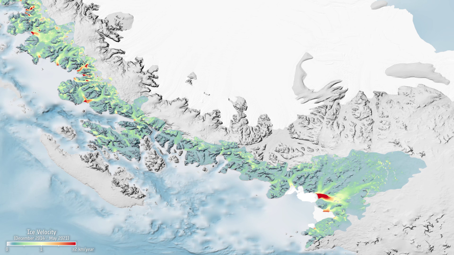
Like many places, the Antarctic Peninsula is falling victim to rising temperatures. However, when scientists used radar images from the Copernicus Sentinel-1 mission acquired between 2014 and 2021, they were taken aback to discover just how the fast 105 glaciers on the west coast are flowing in the summer months.
Young ESA payload destined for space
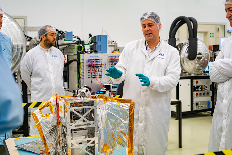
A young group of workers at ESA have come together to design a space payload of their own, with ESA technical experts contributing the technical assistance they needed. The result, Young Professional Satellite, YPSat – was presented to representatives of supporting departments at ESA’s ESTEC technical centre in the Netherlands.
ESA invites space firms to create lunar services
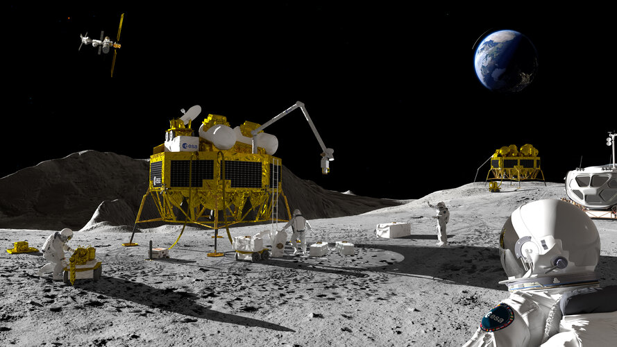
ESA is inviting private space companies in Europe and Canada to create a shared commercial telecommunication and navigation service for lunar missions by putting a constellation of satellites around the Moon.
BeetleSat deploys satellite expandable antenna in LEO orbit
 BeetleSat reports the successful deployment of its lightweight, very high data rate, expandable antenna in space. The in-orbit deployment of BeetleSat's 60 cm expandable antenna from a 6U CubeSat - an industry first - marks a significant milestone in the development of the BeetleSat constellation and proves the viability of its proprietary technology.
BeetleSat's large Ka-band parabolic hi
BeetleSat reports the successful deployment of its lightweight, very high data rate, expandable antenna in space. The in-orbit deployment of BeetleSat's 60 cm expandable antenna from a 6U CubeSat - an industry first - marks a significant milestone in the development of the BeetleSat constellation and proves the viability of its proprietary technology.
BeetleSat's large Ka-band parabolic hi Revolutionary Space Debris Removal Mission Advances to Next Phase
Look on the Bright Side of Earth
 When looking at the Earth from space, its hemispheres - northern and southern - appear equally bright. This is particularly unexpected because the Southern Hemisphere is mostly covered with dark oceans, whereas the Northern Hemisphere has a vast land area that is much brighter than these oceans. For years, the brightness symmetry between hemispheres remained a mystery.
In a new study, publ
When looking at the Earth from space, its hemispheres - northern and southern - appear equally bright. This is particularly unexpected because the Southern Hemisphere is mostly covered with dark oceans, whereas the Northern Hemisphere has a vast land area that is much brighter than these oceans. For years, the brightness symmetry between hemispheres remained a mystery.
In a new study, publ 


