
Copernical Team
'Like a mirror': Astronomers identify most reflective exoplanet
 A scorching hot world where metal clouds rain drops of titanium is the most reflective planet ever observed outside of our Solar System, astronomers said on Monday.
This strange world, which is more than 260 light years from Earth, reflects 80 percent of the light from its host star, according to new observations from Europe's exoplanet-probing Cheops space telescope.
That makes it the
A scorching hot world where metal clouds rain drops of titanium is the most reflective planet ever observed outside of our Solar System, astronomers said on Monday.
This strange world, which is more than 260 light years from Earth, reflects 80 percent of the light from its host star, according to new observations from Europe's exoplanet-probing Cheops space telescope.
That makes it the Guiding Aeolus' safe reentry
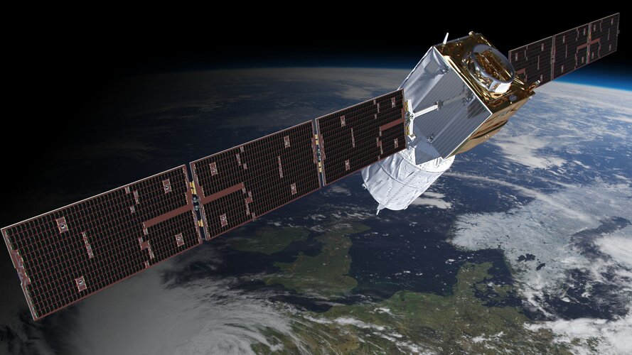
After exceeding its planned life in orbit, ESA’s Aeolus wind satellite is on its way back to Earth. The satellite is currently falling around 1 km a day, and its descent is accelerating. ESA’s spacecraft operators will soon intervene and attempt to guide Aeolus in a first-of-its-kind assisted reentry. Why is ESA doing this?
A look back at our first ESA Academy’s Navigation Training Course
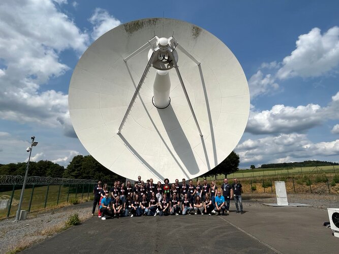
From 26 to 30 June, the first ESA Academy’s Navigation Training Course took place at ESEC-Galaxia, the European Space Security and Education Centre , in Belgium. Developed in collaboration with ESA’s Directorate of Navigation, the course attracted 30 Master and PhD students of 12 different nationalities from engineering and scientific subjects with basic knowledge of Navigation to enrich their university portfolio with a unique experience. Let’s have a look at the event and impressions from the participants!
Train me to the Moon and back
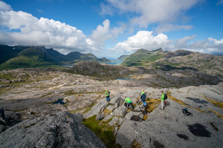
Two European astronauts are following the traces of a treasure trove of rare, Moon-like crystals in a Norwegian fjord as part of the PANGAEA geology training course.
Help ESA research key space-based solar power challenges
Space-based solar power could provide Earth with clean and reliable energy, 24 hours a day. As part of its SOLARIS initiative, ESA is inviting researchers to help advance our knowledge of key aspects of collecting solar power in space and wirelessly transmitting it to Earth.
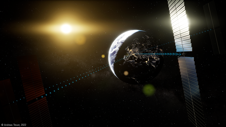
Cheops shows scorching exoplanet acts like a mirror
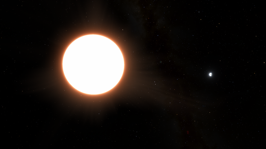
Data from ESA’s exoplanet mission Cheops has led to the surprising revelation that an ultra-hot exoplanet that orbits its host star in less than a day is covered by reflective clouds of metal, making it the shiniest exoplanet ever found.
Solar storm on Thursday expected to make Northern Lights visible in 17 states

AI robots at UN reckon they could run the world better
 A panel of AI-enabled humanoid robots told a United Nations summit on Friday that they could eventually run the world better than humans.
But the social robots said they felt humans should proceed with caution when embracing the rapidly-developing potential of artificial intelligence.
And they admitted that they cannot - yet - get a proper grip on human emotions.
Some of the most a
A panel of AI-enabled humanoid robots told a United Nations summit on Friday that they could eventually run the world better than humans.
But the social robots said they felt humans should proceed with caution when embracing the rapidly-developing potential of artificial intelligence.
And they admitted that they cannot - yet - get a proper grip on human emotions.
Some of the most a No additional radiation at cruising altitude off the coast of Brazil
 Earth's atmosphere protects aircraft passengers and crew from the effects of the South Atlantic Anomaly. At cruising altitude, there is no additional exposure to cosmic radiation off the coast of Brazil. This was confirmed by a German Aerospace Center research team during measurement flights. The results of the study, conducted as Atlantic Kiss mission, have now been published in a scientific jo


