Thursday, 04 July 2024 16:56
Icesat-2 Resumes Data Collection After Solar Storms
Los Angeles CA (SPX) Jul 03, 2024
 the space agencys ICESat-2 satellite returned to science mode on June 21 UTC, after solar storms in May caused its height-measuring instrument to go into a safe hold. The ICESat-2 team restarted the missions instrument, a lidar called the Advanced Topographic Laser Altimeter System (ATLAS), which is once again collecting precise data on the height of Earths ice, water, forests and land cover. No
the space agencys ICESat-2 satellite returned to science mode on June 21 UTC, after solar storms in May caused its height-measuring instrument to go into a safe hold. The ICESat-2 team restarted the missions instrument, a lidar called the Advanced Topographic Laser Altimeter System (ATLAS), which is once again collecting precise data on the height of Earths ice, water, forests and land cover. No
Published in
News
Thursday, 04 July 2024 16:56
Indonesia aims to build cutting-edge spaceport but faces obstacles
Jakarta, Indonesia (VOA) (SPX) Jul 02, 2024
 Indonesia aims to launch 19 satellites into low-Earth orbit next year, part of an ambitious plan to move the country into the forefront of the world's growing space industry and reduce its reliance on other countries for its satellite data.
The broader program, known as the 2045 space map, is set to begin next year. Officials hope to boost Indonesia's economy and drive foreign direct inves
Indonesia aims to launch 19 satellites into low-Earth orbit next year, part of an ambitious plan to move the country into the forefront of the world's growing space industry and reduce its reliance on other countries for its satellite data.
The broader program, known as the 2045 space map, is set to begin next year. Officials hope to boost Indonesia's economy and drive foreign direct inves
Published in
News
Thursday, 04 July 2024 10:26
Eye test for lunar impact surveyor
 Image:
Eye test for lunar impact surveyor
Image:
Eye test for lunar impact surveyor
Published in
News
Thursday, 04 July 2024 09:34
Laser upgrade for Mars rover
 Image:
Laser upgrade for Mars rover
Image:
Laser upgrade for Mars rover
Published in
News
Thursday, 04 July 2024 10:15
Ariane 6 first passengers – with names
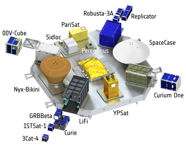 Image:
Ariane 6 first passengers – with names
Image:
Ariane 6 first passengers – with names
Published in
News
Thursday, 04 July 2024 14:09
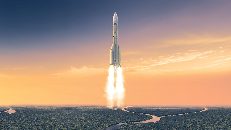
Ariane 6 launch: how to watch and what to look out for
Published in
News
Thursday, 04 July 2024 14:21
Ariane 6 first flight timeline
 Image:
Ariane 6 first flight timeline
Image:
Ariane 6 first flight timeline
Published in
News


Thursday, 04 July 2024 13:42
Airbus secures $2.5 billion German military satellite contract


Published in
News
Thursday, 04 July 2024 14:20
EarthCARE offers a sneak peek into Earth’s energy balance

Offering a foretaste of what’s to come once it is fully commissioned, ESA’s EarthCARE satellite has returned the first images from its broadband radiometer instrument. These initial images offer a tantalising glimpse into the intricacies of our planet’s energy balance – a delicate balance that governs our climate.
Published in
News


")


