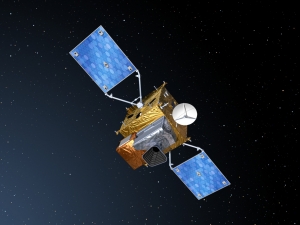
Displaying items by tag: Sentinel EO satellites
Copernicus: Sentinel-4 - GEO Component Mission
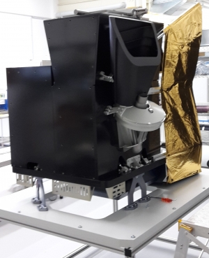
The Sentinel-4 (S-4) mission within the context of Copernicus represents the geostationary component of European (EC, ESA) operational atmospheric composition monitoring missions.
In December 2007, the GMES Atmospheric Service Implementation Group of the EC (European Commission), issued its preliminary recommendations for the development of the GMES Space Segment operational capabilities in regard of atmospheric missions. In particular, it recommended implementing the Sentinel-4 mission as a UVN (UV/Visible/Near-infrared) sounder to be deployed on the two MTG Sounding (MTG-S) satellites. 1) 2) 3) 4) 5) 6)
|
Copernicus is the new name of the European Commission's Earth Observation Programme, previously known as GMES (Global Monitoring for Environment and Security). The new name was announced on December 11, 2012, by EC (European Commission) Vice-President Antonio Tajani during the Competitiveness Council. In the words of Antonio Tajani: "By changing the name from GMES to Copernicus, we are paying homage to a great European scientist and observer: Nicolaus Copernicus (1473-1543). As he was the catalyst in the 16th century to better understand our world, so the European Earth Observation Programme gives us a thorough understanding of our changing planet, enabling concrete actions to improve the quality of life of the citizens. Copernicus has now reached maturity as a programme and all its services will enter soon into the operational phase. Thanks to greater data availability user take-up will increase, thus contributing to that growth that we so dearly need today." |
Table 1: Copernicus is the new name of the former GMES program 7)
Copernicus: Sentinel-3 - Global Sea/Land Monitoring Mission including Altimetry
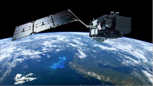
The Sentinel-3 (S3) mission of ESA and the EC is one of the elements of the GMES (Global Monitoring for Environment and Security) program, which responds to the requirements for operational and near-real-time monitoring of ocean, land and ice surfaces over a period of 20 years. The topography element of this mission will serve primarily the marine operational users but will also allow the monitoring of sea ice and land ice, as well as inland water surfaces, using novel observation techniques.The Sentinel-3 mission is designed as a constellation of two identical polar orbiting satellites, separated by 180º, for the provision of long-term operational marine and land monitoring services. The operational character of this mission implies a high level of availability of the data products and fast delivery time, which have been important design drivers for the mission. 1) 2) 3) 4) 5) 6) 7) 8) 9) 10) 11) 12) 13) 14)
The Sentinel-3 program represents a series of operational spacecraft over the envisioned service period to guarantee access to an uninterrupted flow of robust global data products.
Copernicus: Sentinel-2 - The Optical Imaging Mission for Land Services
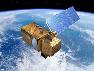
Sentinel-2 is a multispectral operational imaging mission within the GMES (Global Monitoring for Environment and Security) program, jointly implemented by the EC (European Commission) and ESA (European Space Agency) for global land observation (data on vegetation, soil and water cover for land, inland waterways and coastal areas, and also provide atmospheric absorption and distortion data corrections) at high resolution with high revisit capability to provide enhanced continuity of data so far provided by SPOT-5 and Landsat-7. 1) 2) 3) 4) 5) 6) 7) 8)
Copernicus: Sentinel-1 - The SAR Imaging Constellation for Land and Ocean Services
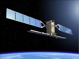
Sentinel-1 is the European Radar Observatory, representing the first new space component of the GMES (Global Monitoring for Environment and Security) satellite family, designed and developed by ESA and funded by the EC (European Commission). The Kopernikus missions (Sentinel-1, -2, and -3) represent the EU contribution to GEOSS (Global Earth Observation System of Systems).
Copernicus Programme
Copernicus is the European Union's Earth observation programme coordinated and managed by the European Union (EU) in partnership with the European Space Agency (ESA), the EU Member States and EU Agencies.
It aims at achieving a global, continuous, autonomous, high quality, wide range Earth observation capacity. Providing accurate, timely and easily accessible information to, among other things, improve the management of the environment, understand and mitigate the effects of climate change, and ensure civil security.
The objective is to use vast amount of global data from satellites and from ground-based, airborne and seaborne measurement systems to produce timely and quality information, services and knowledge, and to provide autonomous and independent access to information in the domains of environment and security on a global level in order to help service providers, public authorities and other international organizations improve the quality of life for the citizens of Europe. In other words, it pulls together all the information obtained by the Copernicus environmental satellites, air and ground stations and sensors to provide a comprehensive picture of the "health" of Earth.
Sentinel satellites
Sentinel is a multi-satellite project to be launched from 2014, being developed by ESA under the Global Monitoring for Environment and Security (GMES) program, renamed as Copernicus program. The Sentinel missions include satellites radar and super-spectral imaging for land, ocean and atmospheric monitoring.
The Sentinel satellite familiy is designed to replace the ENVISAT mission.
Missions
The Sentinel missions will have the following objectives:
- Sentinel 1 will provide all-weather, day and night radar imaging for land and ocean services. The first Sentinel-1 satellite is planned for launch in 2014.
- Sentinel 2 will provide high-resolution optical imaging for land services (e.g. imagery of vegetation, soil and water cover, inland waterways and coastal areas). Sentinel-2 will also provide information for emergency services. The first Sentinel-2 satellite is planned for launch in 2014.
- Sentinel 3 will provide ocean and global land monitoring services. The first Sentinel-3 satellite is planned for launch in 2017.
- Sentinel 4, embarked as a payload upon a Meteosat Third Generation Satellite, will provide data for atmospheric composition monitoring. It will be launched in 2019.
- Sentinel 5 Precursor - subset of the Sentinel 5 sensor set planned for launch in 2015. The primary purpose of this was to provide overlapping data (especially SCIAMACHY atmospheric observations) with the aging ENVISAT. However contact with ENVISAT was lost in April 2012 and the mission was declared ended in May 2012. It is unknown whether Sentinel 5 Precursor will be rescheduled as a result.
- Sentinel 5 will also provide data for atmospheric composition monitoring. It will be embarked on a post-EUMETSAT Polar System (EPS) spacecraft and launched in 2020.
- Sentinel 6 is the intent to sustain high precision altimetry missions following the Jason-2 satellite.
B612 Foundation
The B612 Foundation is a private foundation dedicated to protecting the Earth from asteroid strikes. Their immediate goal is to "significantly alter the orbit of an asteroid in a controlled manner by 2015".
The Sentinel program (space telescope) is the cornerstone of the Foundation's efforts (in Nov.2012).
The foundation was established in October 2002. It is named for the home asteroid of the eponymous hero of Antoine de Saint-Exupéry's The Little Prince. Financial contributions to the B612 Foundation are tax-exempt. The foundation principal offices are in Mountain View, California, USA.

