
Copernical Team
Liftoff as Ariane 6 takes flight for the first time
 Image:
Liftoff as Ariane 6 takes flight for the first time
Image:
Liftoff as Ariane 6 takes flight for the first time How Sentinel-1 measured movement of Venezuela quakes

More than one month on from the catastrophic twin earthquakes in northern Venezuela on 24 June 2026, satellite data show the ground displacement was greater than first estimated.
France’s postal service, La Poste, honours Ariane 6

To mark Europe’s newest generation heavy‑lift launcher, La Poste, France’s national postal service, has issued a collector set of eight stamps featuring Ariane 6, paying tribute to Europe’s ambitious space programme.
Vertical liftoff as Ariane 6 takes flight for the first time
 Image:
Vertical liftoff as Ariane 6 takes flight for the first time
Image:
Vertical liftoff as Ariane 6 takes flight for the first time Fires rage near Bordeaux, France
 Image:
These images by the Copernicus Sentinel-2 mission, captured on 26 July, show the area to the west of Bordeaux, France, where wildfires continue to burn countryside, fanned by wind and heatwave conditions.
Image:
These images by the Copernicus Sentinel-2 mission, captured on 26 July, show the area to the west of Bordeaux, France, where wildfires continue to burn countryside, fanned by wind and heatwave conditions. Wildfires near Cebreros ground station, Spain
 Image:
This Copernicus Sentinel-2 image, captured on 26 July, shows a zoomed-in view over ESA's Cebreros ground station, which lies within the areas heavily affected by the wildfires in Spain.
Image:
This Copernicus Sentinel-2 image, captured on 26 July, shows a zoomed-in view over ESA's Cebreros ground station, which lies within the areas heavily affected by the wildfires in Spain. Raging wildfires near Madrid, Spain
 Image:
Raging wildfires near Madrid, Spain
Image:
Raging wildfires near Madrid, Spain Meet space startups at ESA’s Industry Space Days

Startup companies which have come up with brilliant ideas for using space will join the European Space Agency’s (ESA) Industry Space Days (ISD) event on 16–17 September at ESA-ESTEC in the Netherlands.
Over two days Europe’s space industry will exchange ideas, showcase capabilities, discuss collaboration, and explore opportunities with ESA.
Two new Galileo satellites enter service
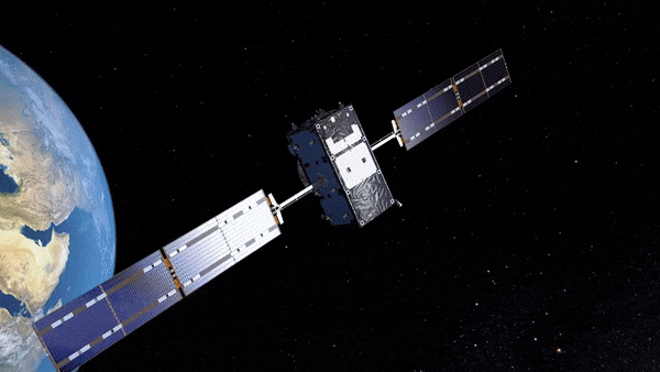
Two new satellites have now officially joined Europe’s Galileo satellite navigation constellation, strengthening its capabilities, resilience and autonomy. Four Galileo First Generation satellites remain to be launched, with the next pair planned for the end of the year.
Earth from Space: Agricultural patchwork
 Image:
The Copernicus Sentinel-2 mission takes us over Australia’s southwestern corner in the Goldfields–Esperance region of Western Australia.
Image:
The Copernicus Sentinel-2 mission takes us over Australia’s southwestern corner in the Goldfields–Esperance region of Western Australia.