Copernical Team
Cheops reveals a rugby ball-shaped exoplanet

ESA’s exoplanet mission Cheops has revealed that an exoplanet orbiting its host star within a day has a deformed shape more like that of a rugby ball than a sphere. This is the first time that the deformation of an exoplanet has been detected, offering new insights into the internal structure of these star-hugging planets.
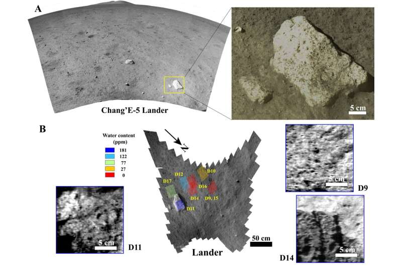
Chang'E-5 lander makes first onsite detection of water on moon

A joint research team led by Profs. Lin Yangting and Lin Honglei from the Institute of Geology and Geophysics of the Chinese Academy of Sciences (IGGCAS) observed water signals in reflectance spectral data from the lunar surface acquired by the Chang'E-5 lander, providing the first evidence of in-situ detection of water on the Moon.
The study was published in Science Advances on Jan. 7.
Researchers from the National Space Science Center of CAS, the University of Hawaiʻi at Mānoa, the Shanghai Institute of Technical Physics of CAS and Nanjing University were also involved in the study.
Many orbital observations and sample measurements completed over the past decade have presented evidence for the presence of water (as hydroxyl and/or H2O) on the moon. However, no in-situ measurements have ever been conducted on the lunar surface.
The Chang'E-5 spacecraft landed on one of the youngest mare basalts, located at a mid-high latitude on the Moon, and returned 1,731 g of samples.
What happens when someone dies in space? Space tourism brings new legal and moral issues

Commercial spaceflight companies such as Virgin Galactic and Blue Origin are now offering exclusive opportunities for celebrities and civilians to travel to space.
Traditionally, astronauts have been subject to rigorous training and medical scrutiny before going to space, and the risk of death from natural causes was considered remote.
But in this new era of space tourism, it appears medical screening may not be carried out, and only minimal pre-flight training provided.
With a wide variety of people now going to space, and the prospect in the coming years of humans establishing bases on the Moon and beyond, it raises an important question: what happens if someone dies in space?
Under international space law, individual countries are responsible for authorizing and supervising all national space activity, whether governmental or private. In the United States, commercial tourist spaceflights require a license for launch to be issued by the Federal Aviation Administration.
Should someone die on a commercial tourist mission, there would need to be a determination as to the cause of death.
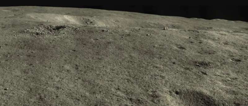
China's rover checks out that weird cube on the moon—surprise! It's a rock.

Back in early December 2021, China's Yutu 2 rover made headlines when it spied what looked like a curious cube-shaped object on the moon's surface. Of course, speculations ran rampant. And it didn't help matters any when the China National Space Administration (CNSA) nicknamed the object the "mystery hut."
An update today from Yutu's cameras reveals the true nature of this object. Yup, it's just a rock. And not very cube-shaped, either.
Several planetary geologists and astronomers had logically predicted the object was likely a just bright colored, blocky boulder sitting on the edge of a crater rim. Orbital images from the Lunar Reconnaissance Orbiter didn't show anything out of the ordinary—rocks and more rocks on a cratered lunar surface.
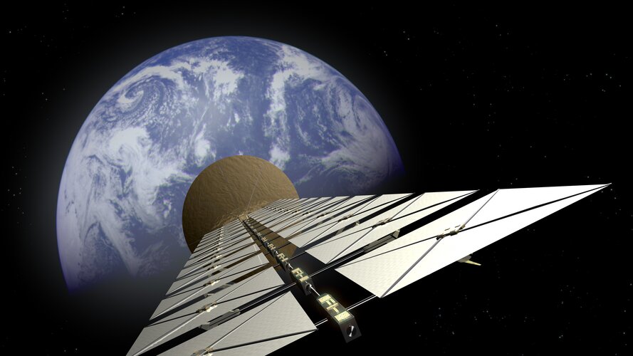
ESA reignites space-based solar power research

We urgently need solutions to tackle climate change on Earth. Meanwhile, the space sector is working hard to make space exploration more sustainable. ESA is targeting both ambitions by enabling European academia and industry to take further steps towards space-based solar power (SBSP).
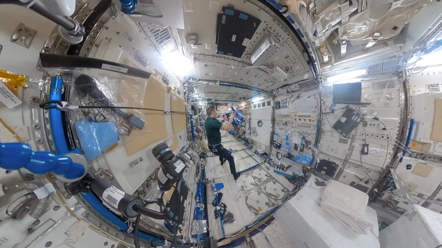
Astrobee robots in 360° | Cosmic Kiss
 Video:
00:02:16
Join ESA astronaut Matthias Maurer inside Kibo, the Japanese laboratory module of the International Space Station in 360°, setting up Astrobee robotic free-flyers for the ReSWARM experiment, short for RElative Satellite sWArming and Robotic Maneuvering. The robotics demonstration tests autonomous microgravity motion planning and control for on-orbit assembly and coordinated motion.
Thus, this investigation aims to test coordination between multiple robots, robots and cargo, and robots and their operating environment as developers envision the future of autonomous robot operations in space.
Matthias was launched to the International Space Station on Crew Dragon Endurance as part of Crew-3 at 02:03
Bringing the Sun into the lab
 Why the Sun's corona reaches temperatures of several million degrees Celsius is one of the great mysteries of solar physics. A "hot" trail to explain this effect leads to a region of the solar atmosphere just below the corona, where sound waves and certain plasma waves travel at the same speed. In an experiment using the molten alkali metal rubidium and pulsed high magnetic fields, a team from t
 No returning to climate of the past even with CO2 reduction
 While the entire world focuses on achieving carbon neutrality - zero carbon dioxide (CO2) emissions - a new research shows climate change in some regions is inevitable even if the already increased CO2 level is reduced. As CO2 decreases, the intertropical convergence zone (ITCZ) shifts southwards, which can trigger persistent El Nino conditions. El Nino refers to a phenomenon in which the sea su
 New year's mission to start new phase of exoplanet research
 A mission to one of the coldest and most remote places on earth will enable a new phase in the search for distant planetary systems. University of Birmingham PhD researcher Georgina Dransfield has travelled to the Franco-Italian Concordia Research Station in Antarctica, to oversee the installation of a new state-of-the-art camera at the ASTEP (Antarctic Search for Transiting ExoPlanets) telescop
 Sending Life to the Stars
 No longer solely in the realm of science fiction, the possibility of interstellar travel has appeared, tantalizingly, on the horizon. Although we may not see it in our lifetimes - at least not some real version of the fictional warp-speeding, hyperdriving, space-folding sort - we are having early conversations of how life could escape the tether of our solar system, using technology that is with