
Copernical Team
NASA enters the solar atmosphere for the first time, bringing new discoveries

For the first time in history, a spacecraft has touched the Sun. NASA's Parker Solar Probe has now flown through the Sun's upper atmosphere—the corona—and sampled particles and magnetic fields there.
The new milestone marks one major step for Parker Solar Probe and one giant leap for solar science. Just as landing on the Moon allowed scientists to understand how it was formed, touching the very stuff the Sun is made of will help scientists uncover critical information about our closest star and its influence on the solar system.
Video: Double drop test success for ExoMars parachutes
. The graphic is not to scale, and the colours of the parachutes are for illustrative purposes only. Credit: European Space Agency")
The largest parachute set to fly on Mars has completed its first successful high-altitude drop test, a critical milestone for ensuring the ExoMars mission is on track for launch in 2022. Both the first and second stage parachutes have now successfully flown this year.
A pair of high-altitude drop tests took place in Oregon on 21 November and 3 December as part of the ongoing parachute testing to ensure the safe delivery of the ExoMars Rosalind Franklin rover and Kazachok lander to the surface of Mars in June 2023.
Locked in stone: Mars' missing water might be stored in clay mineral

A clay mineral known as smectite could hold a substantial portion of the water missing from Mars, according to new research from Binghamton University, State University of New York.
Rivers and streams once flowed across the surface of Mars, etching channels still evident on the planet's surface today. Water in lakes once lapped ancient shores. But today, Mars' red sands appear bone-dry. Where did all that water go?
Some of that water is trapped in the planet's polar ice caps, which behave like stone due to Mars' frigid temperatures. The rest may have gone underground, locked inside clay minerals such as smectite.
New research from Binghamton University Geological Sciences and Environmental Studies Professor David Jenkins and former graduate student Brittany DePasquale provides information on how deep smectite could occur in the surface rocks of Mars. They found that iron-rich smectite, the least-stable form of smectite, can form to depths up to 30 km, much deeper than others might have predicted. In view of this rather robust stability for smectite, it appears that clay minerals are able to receive and store the missing water on Mars.
Aeolus paves the way for future wind lidars in space
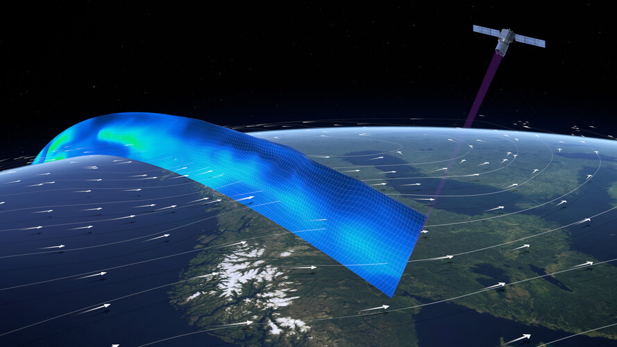
It’s hard to believe that ESA’s Aeolus wind mission has now been orbiting Earth for three years and, remarkably, exceeded its design life milestone. Aeolus has gone way further than its original goal of demonstrating that ground-breaking laser technology can deliver global profiles of the wind; its data are being distributed to weather forecasting services across the world in less than three hours of measurements being made in space. Moreover, Aeolus has laid the foundation for future Doppler wind lidar satellite missions.
Solar Orbiter publishes a wealth of science results from its cruise phase

For a mission yet to have entered its main science phase, Solar Orbiter has already generated a lot of great science. Today sees the publication of a wealth of results from the mission’s cruise phase.
Webb placed on top of Ariane 5
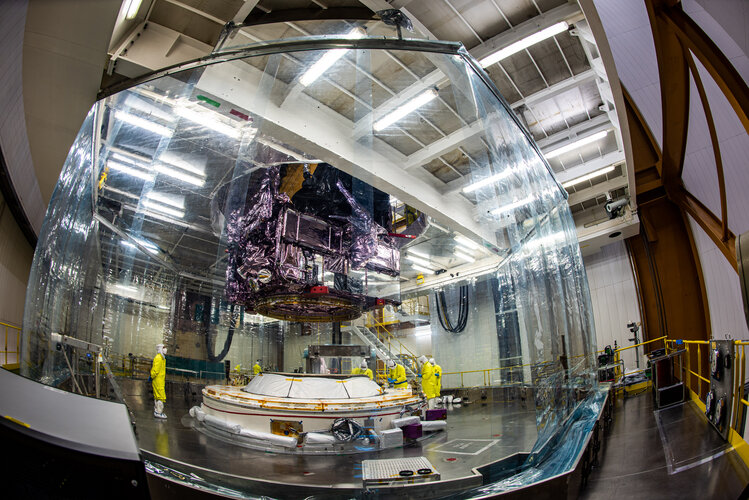
On Saturday 11 December, the James Webb Space Telescope was placed on top of the Ariane 5 rocket that will launch it to space from Europe’s Spaceport in French Guiana.
How to see comet Leonard, according to the researcher who discovered it
 is seen next to globular star cluster M3 in this image taken with the Schulman Telescope at UArizona's Mount Lemmon Sky Center. Credit: Adam Block/Steward Observatory/University of Arizona")
Now is the best time to get a glimpse of Comet C/2021 A1, better known as Comet Leonard. It's named for its discoverer, Gregory Leonard, a senior research specialist at the University of Arizona Lunar and Planetary Laboratory.
Every night with clear skies, astronomers with LPL's Catalina Sky Survey scan the sky for near-Earth asteroids—space rocks with the potential of venturing close to Earth at some point.
During one such routine observation run on Jan. 3, Leonard spotted a fuzzy patch of light tracking across the starfield background in a sequence of four images taken with the 1.5-meter telescope at the summit of Mount Lemmon.
Webb and Ariane 5 – Preparing for launch
 Video:
00:04:00
Video:
00:04:00
The world’s next generation cosmic observatory, the James Webb Space Telescope, is due for launch on an Ariane 5 from Europe’s Spaceport in French Guiana.
Webb is a joint project between NASA, the European Space Agency, and the Canadian Space Agency and is a remarkable feat of engineering and technology. The telescope is fitted with the largest astronomical mirror ever flown in space, sophisticated new scientific instruments, and a sunshield the size of a tennis court.
Ariane 5 is one of the most reliable launch vehicles in the world and special modifications have been made for the preparation and
TEC Business to Business website

TEC Business to Business website
Software-defined OneSat ready for production
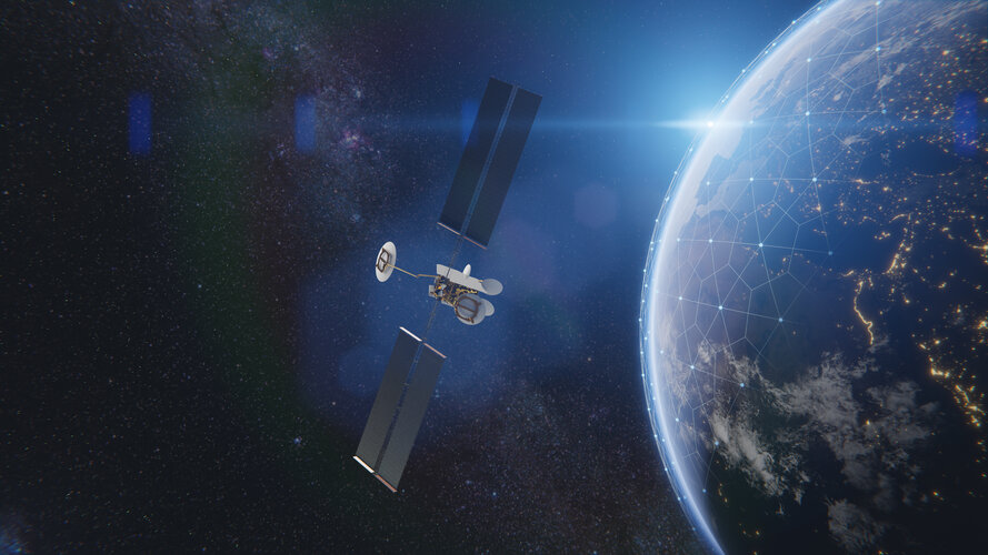
The latest type of telecommunication satellite that can respond from space to changing demands on Earth is about to start assembly of its electronic components.