
Copernical Team
Yup, Earth is still there: GOES-18 goes online, sends 1st image of planet

"Hello, world!"
A NASA tweet greeted the internet Wednesday with a beautiful image of the bluish gem-like Earth—the first image captured by the newest weather satellite orbiting the planet.
GOES-18, short for Geostationary Operational Environmental Satellite, blasted off in March from Cape Canaveral Space Force Station on a United Launch Alliance Atlas V rocket thanks to a collaboration between the National Oceanic and Atmospheric Administration and NASA along with several other partners.
GOES-18 is a weather monitoring satellite that should help meteorologists determine potential areas of disaster before they occur in the western part of the United States as well as Alaska and Hawaii, according to the NOAA. It will primarily be used to monitor and predict disaster events like hurricanes, thunderstorms, floods, dense fog and fire.
Among its utility belt of tools, GOES-18 has an Advanced Baseline Imager (ABI), which can view the Earth in 16 different kinds of spectral bands including two visible channels, four near-infrared channels and 10 infrared channels. The previous generation of GOES could only view five different bands. The ABI will help scientists predict where fires on the west coast could start before they ever form, said Pam Sullivan director of the GOES-R program.
Forward to the Moon: An interactive publication about our natural satellite!
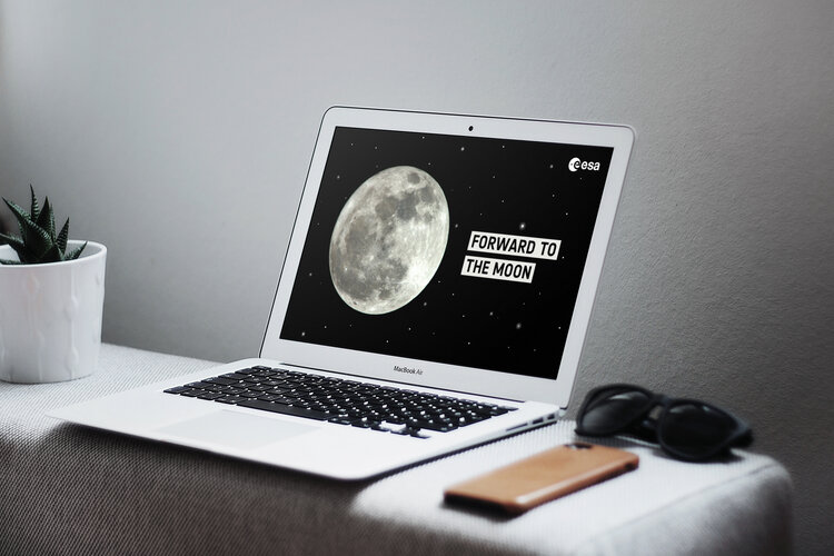
Forward to the Moon
This is an interactive publication about our natural satellite
Eight things you never knew about mining on Mars, the Moon, and even asteroids

Off-earth mining may once have been purely the stuff of science fiction, but now it's potentially a US$1 trillion industry that is likely to be vital if humans are serious about colonizing Mars or the moon.
Sustaining life on other planetary bodies will almost certainly require the use of in-situ resources which currently remain untapped.
UNSW experts—Professor Andrew Dempster and Professor Serkan Saydam, the director and deputy director of the Australian Center for Space Engineering Research (ACSER)—say the challenges posed by mining such materials in space are enormous.
Robotics may be the answer, but even terrestrial mining systems are not yet fully autonomous, so new technologies will need to be developed.
Telling sunset
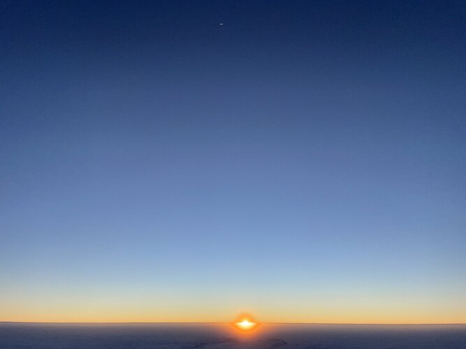 Image:
The penultimate sunset at Concordia research station in Antarctica marks the beginning of a very exciting time for the 12-member crew: the coming of Antarctic night and the winter-over.
ESA sponsored medical doctor Hannes Hagson and his crew mates are finally embarking on their ‘real’ mission in Antarctica: living and work in isolation for six months in the name of spaceflight research.
The Italian-French outpost Concordia is located 3233 m above sea level where temperatures can drop to –80°C in the complete frozen darkness outside. The sun disappears behind the horizon for four months. No supplies or people can be flown
Astronomers find 'gold standard' star in Milky Way
 In our sun's neighborhood of the Milky Way Galaxy is a relatively bright star, and in it, astronomers have been able to identify the widest range of elements in a star beyond our solar system yet.
The study, led by University of Michigan astronomer Ian Roederer, has identified 65 elements in the star, HD 222925. Forty-two of the elements identified are heavy elements that are listed along
In our sun's neighborhood of the Milky Way Galaxy is a relatively bright star, and in it, astronomers have been able to identify the widest range of elements in a star beyond our solar system yet.
The study, led by University of Michigan astronomer Ian Roederer, has identified 65 elements in the star, HD 222925. Forty-two of the elements identified are heavy elements that are listed along Traveling to the centre of planet Uranus
 Caption: Materials synthesis research and study in terapascal range for the first time
Jules Verne could not even dream of this: A research team from the University of Bayreuth, together with international partners, has pushed the boundaries of high-pressure and high-temperature research into cosmic dimensions.
For the first time, they have succeeded in generating and simultaneously analy
Caption: Materials synthesis research and study in terapascal range for the first time
Jules Verne could not even dream of this: A research team from the University of Bayreuth, together with international partners, has pushed the boundaries of high-pressure and high-temperature research into cosmic dimensions.
For the first time, they have succeeded in generating and simultaneously analy Chinese rover detects water existed on Mars more recently than thought
 Nearly one year after landing on Mars, scientists say China's Zhurong rover collected data indicating water may have existed on the planet over a longer period of time than previously thought.
A study published Wednesday in the journal Science Advances said Zhurong detected evidence that the Utopia Planitia basin had "substantial" liquid water during its most recent epoch of geologic hi
Nearly one year after landing on Mars, scientists say China's Zhurong rover collected data indicating water may have existed on the planet over a longer period of time than previously thought.
A study published Wednesday in the journal Science Advances said Zhurong detected evidence that the Utopia Planitia basin had "substantial" liquid water during its most recent epoch of geologic hi Multi Part Driving and More - Sols 3469-3470
 Curiosity is getting a good start to the week! The weekend plan completed successfully, leaving some great rover tracks behind us as seen in the attached picture. Today my role was "RP2", which supports the Rover Planners for the day in planning the arm and drive activities, and doing our final modeling and verification steps before sending the commands to the rover.
Sol 3469 will start ou
Curiosity is getting a good start to the week! The weekend plan completed successfully, leaving some great rover tracks behind us as seen in the attached picture. Today my role was "RP2", which supports the Rover Planners for the day in planning the arm and drive activities, and doing our final modeling and verification steps before sending the commands to the rover.
Sol 3469 will start ou Ariel Ekblaw on building beautiful architecture in space
 Living in space today is a cramped and utilitarian endeavor. Astronuats who arrive on the International Space Station (ISS) are prepared for a stay in tight quarters, surrounded by exposed wiring, bulky electronics, and floor-to-ceiling beige paneling.
But what if in-orbit accomodations could be more spacious, livable, and even beautiful? That's a question driving TESSERAE, an ambitious sp
Living in space today is a cramped and utilitarian endeavor. Astronuats who arrive on the International Space Station (ISS) are prepared for a stay in tight quarters, surrounded by exposed wiring, bulky electronics, and floor-to-ceiling beige paneling.
But what if in-orbit accomodations could be more spacious, livable, and even beautiful? That's a question driving TESSERAE, an ambitious sp Powering the moon: Sandia researchers design microgrid for future lunar base
 Sandia National Laboratories is well-known for designing reliable and resilient microgrids for military bases and vital city services. Now, Sandia researchers are working with NASA to design one for the moon.
This is not the first time Sandia has partnered with NASA to power equipment on the moon. In fact, Sandia provided the technical direction for the radioisotope thermoelectric generato
Sandia National Laboratories is well-known for designing reliable and resilient microgrids for military bases and vital city services. Now, Sandia researchers are working with NASA to design one for the moon.
This is not the first time Sandia has partnered with NASA to power equipment on the moon. In fact, Sandia provided the technical direction for the radioisotope thermoelectric generato