Copernical Team
NASA provides update to astronaut moon lander plans under Artemis
 As NASA makes strides to return humans to the lunar surface under Artemis, the agency announced plans Wednesday to create additional opportunities for commercial companies to develop an astronaut Moon lander.
Under this new approach, NASA is asking American companies to propose lander concepts capable of ferrying astronauts between lunar orbit and the lunar surface for missions beyond Arte
 All-private Axiom mission to ISS could launch as early as April 3
 Axiom Space, a private space company, expects to send the first all-private crew to the International Space Station as early as April 3 pending weather conditions and other scheduling concerns, NASA officials said Friday.
The Ax-1 mission passed its flight readiness review, representatives from NASA, Axiom Space and SpaceX - which is providing a Falcon 9 rocket to launch the mission --
 Rocket Lab confirms next launch and updates on Q1 Revenue Guidance
 Rocket Lab USA (Nasdaq: RKLB) has announced the launch window for its next Electron mission, a dedicated mission for BlackSky (NYSE: BKSY) through global launch services provider Spaceflight Inc., begins April 1, 2022 UTC.
This launch window opening in April rather than March is weather related and will result in this mission and its related revenue being recognized in Rocket Lab's fiscal
 Week in images: 21 - 25 March 2022

Week in images: 21 - 25 March 2022
Discover our week through the lens
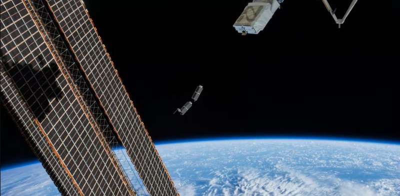
Tiny satellites are changing the way we explore our planet and beyond

Want to go to space? It could cost you.
This month, the SpaceX Crew Dragon spacecraft will make the first fully-private, crewed flight to the International Space Station. The going price for a seat is US$55 million. The ticket comes with an eight-day stay on the space station, including room and board—and unrivaled views.
Virgin Galactic and Blue Origin offer cheaper alternatives, which will fly you to the edge of space for a mere US$250,000–500,000. But the flights only last between ten and 15 minutes, barely enough time to enjoy an in-flight snack.
But if you're happy to keep your feet on the ground, things start to look more affordable. Over the past 20 years, advances in tiny satellite technology have brought Earth orbit within reach for small countries, private companies, university researchers, and even do-it-yourself hobbyists.
Science in space
We are scientists who study our planet and the universe beyond. Our research stretches to space in search of answers to fundamental questions about how our ocean is changing in a warming world, or to study the supermassive black holes beating in the hearts of distant galaxies.
Webb's infrared universe
 Video:
00:01:00
The James Webb Space Telescope (Webb) will observe the Universe in the near-infrared and mid-infrared – at wavelengths longer than visible light.
By viewing the Universe at infrared wavelengths with an unprecedented sensitivity Webb will open up a new window to the cosmos. With infrared wavelengths it can see the first stars and galaxies forming after the Big Bang. Its infrared vision also allows Webb to study stars and planetary systems forming inside thick clouds of gas and dust that are opaque to visible light.
The primary goals of Webb are to study galaxy, star and planet formation
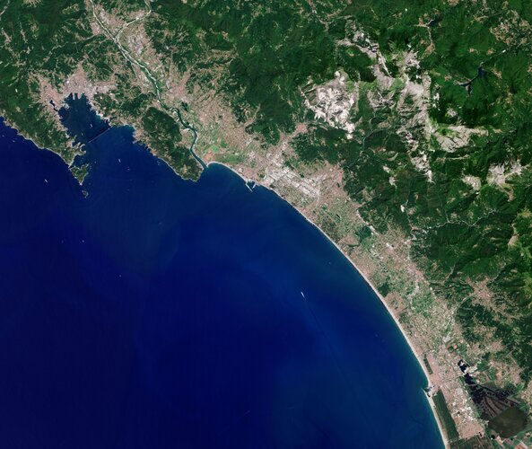
Earth from Space: Carrara, Italy

The Copernicus Sentinel-2 mission takes us over Carrara – an Italian city known especially for its world-famous marble.
Blow a Cosmic Kiss
 Image:
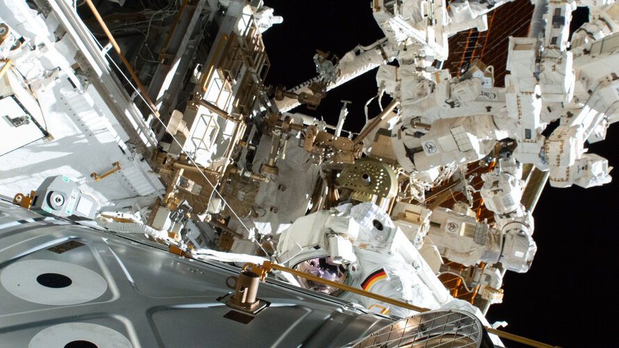
We spy from way up high an ESA astronaut dangling from the International Space Station.
Matthias Maurer performed his first spacewalk during his Cosmic Kiss mission yesterday with fellow astronaut Raja Chari of NASA. Extravehicular activity or EVA 80 lasted 6 hours and 54 minutes and was not without some excitement.
An hour into the spacewalk, the camera and light assembly on Matthias’ helmet needed some readjustments, which Raja was able to fix using some wiring. The duo were then able to carry on with the tasks, which included installing hoses on a radiator beam valve module that helps regulate Space
On icy moon Enceladus, expansion cracks let inner ocean boil out
 In 2006, the Cassini spacecraft recorded geyser curtains shooting forth from "tiger stripe" fissures near the south pole of Saturn's moon Enceladus - sometimes as much as 200 kilograms of water per second. A new study suggests how expanding ice during millennia-long cooling cycles could sometimes crack the moon's icy shell and let its inner ocean out, providing a possible explanation for the gey
 Space X's Crew-4 Dragon capsule named 'Freedom'
 Space X's fourth Dragon capsule to carry astronauts to space has been named "Freedom," bringing the name of the first capsule to fly an American into space to a new generation.
The fourth Dragon mission to carry astronauts is set to launch from NASA's Kennedy Space Center in Florida to the International Space Station on April 19.
The mission was originally slated to launch on Apr