Displaying items by tag: EnviSat
Copernicus Programme
Copernicus is the European Union's Earth observation programme coordinated and managed by the European Union (EU) in partnership with the European Space Agency (ESA), the EU Member States and EU Agencies.
It aims at achieving a global, continuous, autonomous, high quality, wide range Earth observation capacity. Providing accurate, timely and easily accessible information to, among other things, improve the management of the environment, understand and mitigate the effects of climate change, and ensure civil security.
The objective is to use vast amount of global data from satellites and from ground-based, airborne and seaborne measurement systems to produce timely and quality information, services and knowledge, and to provide autonomous and independent access to information in the domains of environment and security on a global level in order to help service providers, public authorities and other international organizations improve the quality of life for the citizens of Europe. In other words, it pulls together all the information obtained by the Copernicus environmental satellites, air and ground stations and sensors to provide a comprehensive picture of the "health" of Earth.
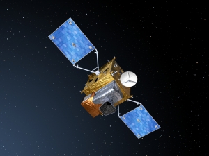
Envisat
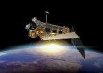
Envisat ("Environmental Satellite") is an Earth observation satellite. Its objective is to service the continuity of European Remote-Sensing Satellite missions, providing additional observational parameters to improve environmental studies.
In working towards the global and regional objectives of the mission, numerous scientific disciplines use the data acquired from the different sensors on the satellite, to study such things as atmospheric chemistry, ozone depletion, biological oceanography, ocean temperature and colour, wind waves, hydrology (humidity, floods), agriculture and arboriculture, natural hazards, digital elevation modelling (using interferometry), monitoring of maritime traffic, atmospheric dispersion modelling (pollution), cartographyand study of snow and ice.
It was launched on 1 March 2002 aboard an Ariane 5 from the Guyana Space Centre in Kourou, French Guyana into a Sun synchronous polar orbit at an altitude of 790 km (490 mi) (± 10 km (6.2 mi)). It orbits the Earth in about 101 minutes with a repeat cycle of 35 days.
Envisat is the largest earth observation satellite put into space (as of late 2006), being 26 m (85 ft) × 10 m (33 ft) × 5 m (16 ft) and having a mass of 8.5 t (8.4 long tons; 9.4 short tons).
The Envisat mission ended on 08 April 2012, following the unexpected loss of contact with the satellite.
Envisat data collectively provide a wealth of information on the workings of the Earth system, including insights into factors contributing to climate change.